| Item Detail |
| |
| |
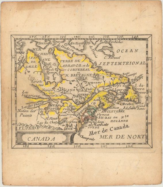
MapMaker: |
Pierre Duval
|
|
| |
| |
Subject: |
Colonial Northeastern United States & Canada |
|
| |
Period/Size: |
1682 / 3.8" x 4.8" (9.7 x 12.2 cm)
|
|
| |
Color: |
Colored
|
|
| |
Condition: |
(B+) On watermarked paper with a light dampstain at left. There are remnants of cello tape along the top edge of the sheet on verso with some minor staining on recto far from the image. (condition help) |
|
| |
Source: |
Le Monde ou la Geographie Universelle |
|
| |
References: |
Burden #351; Kershaw #141; McCorkle #661.1; King (2nd ed) pp. 132-135; Pastoureau, Duval XI Fa. |
|
| |
|
|
| Sales Information |
| |
| |
Price: |
|
|
| |
| |
Offered by: |
Old World Auctions |
|
| |
Catalog: |
Auction No. 168 - Antique Maps, Charts, Atlases & Globes (9436) |
|
| |
Lot/Item #: |
125 |
|
| |
| |
Date: |
06/2018
|
|
| |
| |
|