| Item Detail |
| |
| |
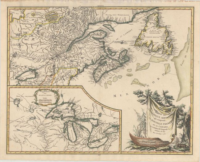
MapMaker: |
Didier Robert de Vaugondy
|
|
| |
| |
Subject: |
Colonial Northeastern United States & Canada, Great Lakes |
|
| |
Period/Size: |
1755 / 18.6" x 23.5" (47.3 x 59.7 cm)
|
|
| |
Color: |
Colored
|
|
| |
Condition: |
(A) A nice impression with a couple of unobtrusive spots. There are old tape stains along the top edge of the sheet, and remnants of hinge tape on verso, all confined to the blank margins and not affecting the map. (condition help) |
|
| |
Source: |
Atlas Universel |
|
| |
References: |
Kershaw #355; Pedley #459; Sellers and Van Ee #61; Karpinski p.141-42; McCorckle #755.36. |
|
| |
|
|
| Sales Information |
| |
| |
Price: |
|
|
| |
| |
Offered by: |
Old World Auctions |
|
| |
Catalog: |
Auction No. 168 - Antique Maps, Charts, Atlases & Globes (9436) |
|
| |
Lot/Item #: |
127 |
|
| |
| |
Date: |
06/2018
|
|
| |
| |
|