| Item Detail |
| |
| |
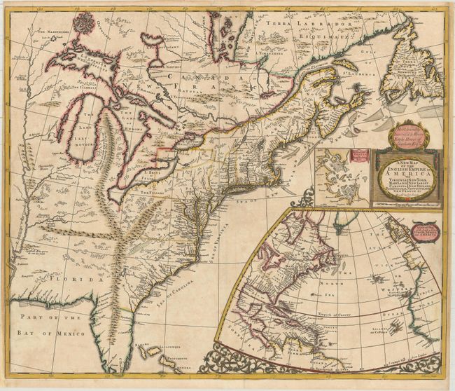
MapMaker: |
John Senex
|
|
| |
| |
Subject: |
Colonial Eastern United States & Canada |
|
| |
Period/Size: |
1719 / 19.9" x 23.6" (50.6 x 60.0 cm)
|
|
| |
Color: |
Colored
|
|
| |
Condition: |
(B+) A crisp impression on paper with a fleur-de-lis and "HD" watermarks. There is light toning and soiling, as well as professional repairs to a few minor separations along the centerfold and to a couple of short edge tears that enter less than 1" into (condition help) |
|
| |
Source: |
|
|
| |
References: |
Burden #750; Cumming (SE) #172; Kershaw #326; McCorkle #719.7; cf. Pritchard & Taliaferro #68; Stevens & Tree (MCC-39) #20b. |
|
| |
|
|
| Sales Information |
| |
| |
Price: |
|
|
| |
| |
Offered by: |
Old World Auctions |
|
| |
Catalog: |
Auction No. 168 - Antique Maps, Charts, Atlases & Globes (9436) |
|
| |
Lot/Item #: |
129 |
|
| |
| |
Date: |
06/2018
|
|
| |
| |
|