| Item Detail |
| |
| |
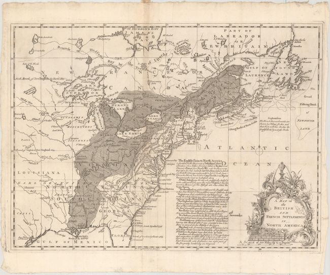
MapMaker: |
Thomas Phinn
|
|
| |
| |
Subject: |
Colonial Eastern United States & Canada |
|
| |
Period/Size: |
1755 / 10.9" x 15.0" (27.7 x 38.1 cm)
|
|
| |
Color: |
Black & White
|
|
| |
Condition: |
(B+) Issued folding on a watermarked sheet with a couple of small fold separations at center and an associated small tear that have all been closed on verso with archival materials. (condition help) |
|
| |
Source: |
Scots Magazine |
|
| |
References: |
Jolly #SCOT-7; Phillips (M) p. 574; Sellers & Van Ee #66. |
|
| |
|
|
| Sales Information |
| |
| |
Price: |
|
|
| |
| |
Offered by: |
Old World Auctions |
|
| |
Catalog: |
Auction No. 168 - Antique Maps, Charts, Atlases & Globes (9436) |
|
| |
Lot/Item #: |
131 |
|
| |
| |
Date: |
06/2018
|
|
| |
| |
|