Title:
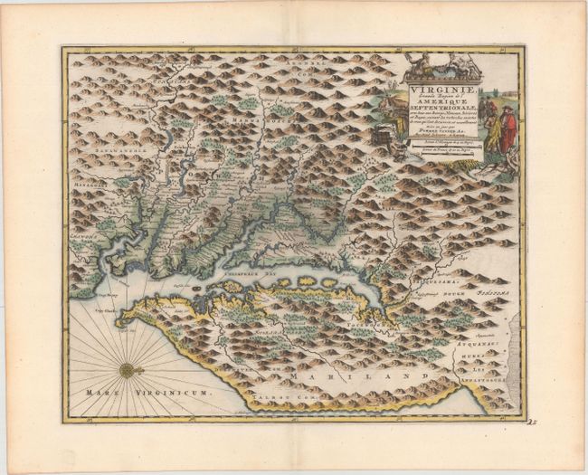
“Virginie, Grande Region de l'Amerique Septentrionale, avec tous Ses Bourgs, Hameaux, Rivieres et Bayes...”
Map Maker:
Pieter van der Aa
This is a rare map of the Chesapeake Bay based on ... (full text available to subscribers)
| Item Detail |
| |
| |
MapMaker: |
Pieter van der Aa
|
|
| |
| |
Subject: |
Colonial Mid-Atlantic United States |
|
| |
Period/Size: |
1729 / 11.4" x 14.1" (29.0 x 35.9 cm)
|
|
| |
Color: |
Colored
|
|
| |
Condition: |
(A+) Excellent impression on paper with a Strasburg Lily watermark with the counter-mark of Abraham Janssen. Minor toning along edges of sheet. (condition help) |
|
| |
Source: |
La Galerie Agreable du Monde... |
|
| |
References: |
Burden #412; Tooley (Amer) p. 169. |
|
| |
|
|
| Sales Information |
| |
| |
Price: |
|
|
| |
| |
Offered by: |
Old World Auctions |
|
| |
Catalog: |
Auction No. 168 - Antique Maps, Charts, Atlases & Globes (9436) |
|
| |
Lot/Item #: |
164 |
|
| |
| |
Date: |
06/2018
|
|
| |
| |
|
Antique Maps - Valuation and Pricing, Descriptions, Resources |
|
Home |
Information |
Search |
Register |
Contact Us |
Site Map
Americana Exchange, Inc. © 1999 - 2024 Americana Exchange, Inc.. All rights reserved.
OldMaps.com, the OldMaps.com logo and
AMPR are service marks or registered service marks of Americana Exchange, Inc..
|