Title:
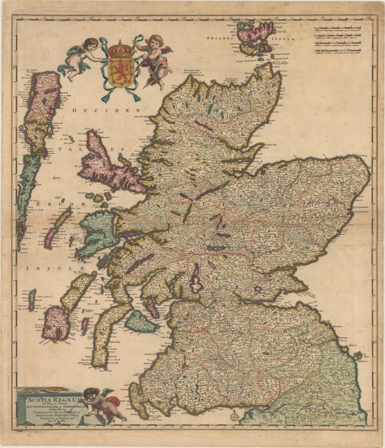
“Scotia Regnum Divisum in Partem Septentrionalem et Meridionalem Subdivisas in Comitatus, Vicecomitatus Provincias Praefecturas Dominia et Insulas”
Map Maker:
Frederick de Wit
This is a superb, classical Dutch map of Scotland ... (full text available to subscribers)
| Item Detail |
| |
| |
MapMaker: |
Frederick de Wit
|
|
| |
| |
Subject: |
Scotland |
|
| |
Period/Size: |
1690 / 22.6" x 20.0" (57.4 x 50.8 cm)
|
|
| |
Color: |
Colored
|
|
| |
Condition: |
(B) Original color with a number of small edge tears and centerfold separations that have been closed and reinforced with old paper. There is scattered foxing, light toning, and a small chip in the top right corner with a tiny portion of the neatline rep (condition help) |
|
| |
Source: |
|
|
| |
References: |
|
|
| |
|
|
| Sales Information |
| |
| |
Price: |
|
|
| |
| |
Offered by: |
Old World Auctions |
|
| |
Catalog: |
Auction No. 168 - Antique Maps, Charts, Atlases & Globes (9436) |
|
| |
Lot/Item #: |
444 |
|
| |
| |
Date: |
06/2018
|
|
| |
| |
|
Antique Maps - Valuation and Pricing, Descriptions, Resources |
|
Home |
Information |
Search |
Register |
Contact Us |
Site Map
Americana Exchange, Inc. © 1999 - 2024 Americana Exchange, Inc.. All rights reserved.
OldMaps.com, the OldMaps.com logo and
AMPR are service marks or registered service marks of Americana Exchange, Inc..
|