| Item Detail |
| |
| |
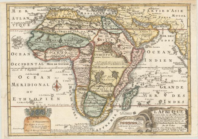
MapMaker: |
Nicolas de Fer
|
|
| |
| |
Subject: |
Africa |
|
| |
Period/Size: |
1717 / 9.0" x 12.4" (22.9 x 31.5 cm)
|
|
| |
Color: |
Colored
|
|
| |
Condition: |
(A) A crisp impression on watermarked paper, issued folding and now flattened with minute holes at the fold intersections. There is minor toning along the top edge of the sheet and the binding trim at left has been professionally replaced with a short ad (condition help) |
|
| |
Source: |
L'Atlas Curieux ou le Monde... |
|
| |
References: |
Betz #170.3; Norwich #64 (larger version); Pastoureau, FER ID. |
|
| |
|
|
| Sales Information |
| |
| |
Price: |
|
|
| |
| |
Offered by: |
Old World Auctions |
|
| |
Catalog: |
Auction No. 168 - Antique Maps, Charts, Atlases & Globes (9436) |
|
| |
Lot/Item #: |
657 |
|
| |
| |
Date: |
06/2018
|
|
| |
| |
|