Title:
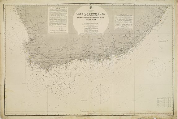
“South Africa - Cape of Good Hope and adjacent coasts from Hondeklip Bay to Port Natal. Chart 2176”
Map Maker:
British Admiralty
THE HYDROGRAPHIC OFFICE OF THE ADMIRALTY, London, ... (full text available to subscribers)
| Item Detail |
| |
| |
MapMaker: |
British Admiralty
|
|
| |
| |
Subject: |
Southern Africa |
|
| |
Period/Size: |
1903 / 25.2" x 38.2" (64.0 x 97.0 cm)
|
|
| |
Color: |
Black & White
|
|
| |
Condition: |
Traces of humidity along lower margin, affecting the bottom scale frame. Lower right margin consolidated. Professional repair of marginal split upper center fold. A few spots. (condition help) |
|
| |
Source: |
|
|
| |
References: |
|
|
| |
|
|
| Sales Information |
| |
| |
Price: |
|
|
| |
| |
Offered by: |
Paulus Swaen Old Maps & Prints |
|
| |
Catalog: |
September 18, 2018 - Internet Auction (9437) |
|
| |
Lot/Item #: |
22846 |
|
| |
| |
Date: |
09/2018
|
|
| |
| |
|
Antique Maps - Valuation and Pricing, Descriptions, Resources |
|
Home |
Information |
Search |
Register |
Contact Us |
Site Map
Americana Exchange, Inc. © 1999 - 2024 Americana Exchange, Inc.. All rights reserved.
OldMaps.com, the OldMaps.com logo and
AMPR are service marks or registered service marks of Americana Exchange, Inc..
|