Rister or Sign In to see pricing information


Title:

Map of North America Designed to Accompany Smith's Geography for Schools

Map Maker:

Daniel Burgess [& Co.]

Map of North America Designed to Accompany Smith's Geography for Schools

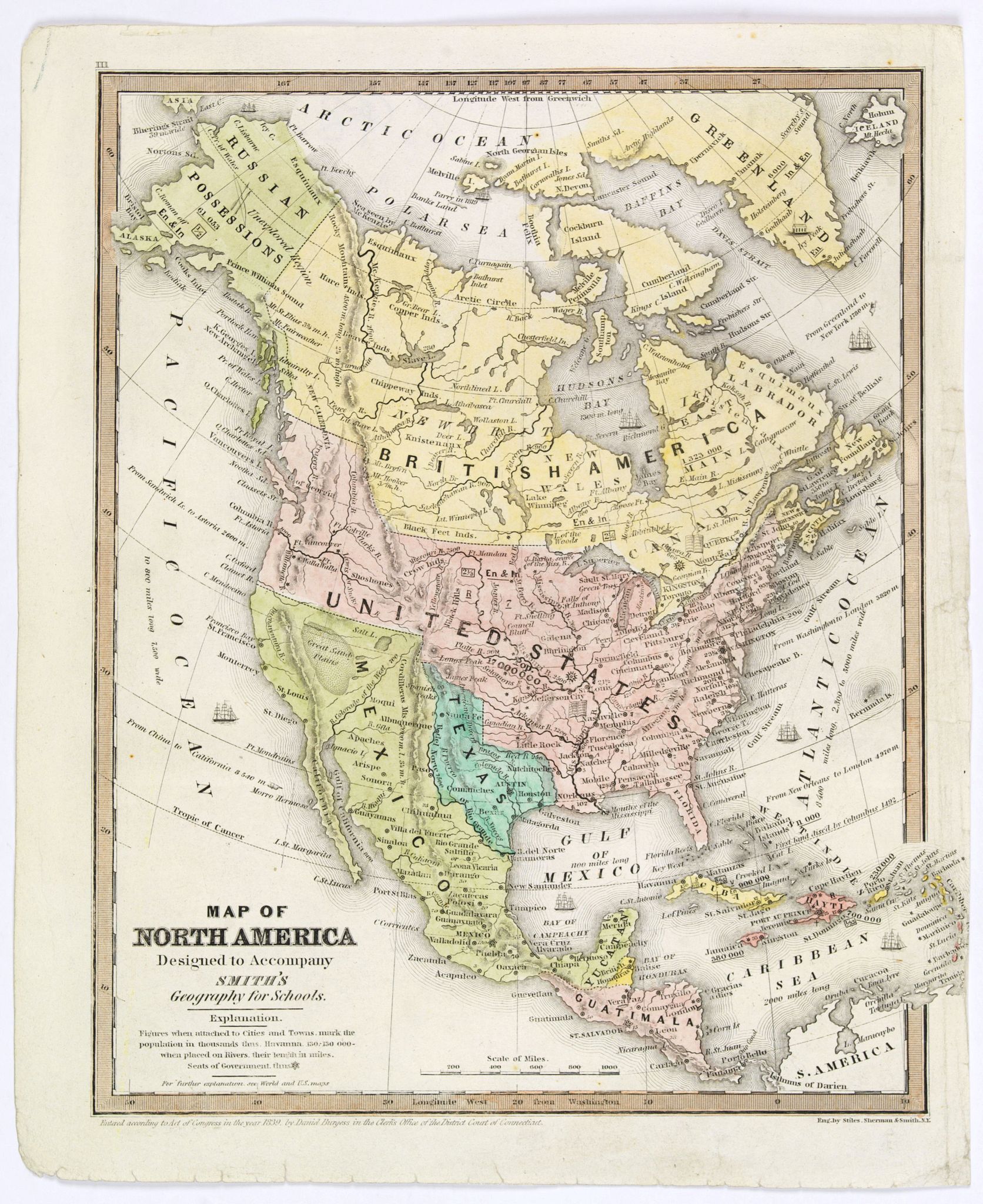
An uncommon schoolboy map of North America, showin... (full text available to subscribers)
Item Detail
 
  MapMaker:  

Daniel Burgess [& Co.]


  Subject:  North America, Texas  
  Period/Size:  c. 1839 / 10.3" x 8.2"  (26.2 x 20.8 cm)  
  Color:  Colored  
  Condition:  In good condition, small repair to right hand margin, lightly toned and finger soiled. Decent margins, good impression. In original colours. (condition help)  
  Source:   
  References:   
 
 
Sales Information
 
  Price: 

Please register your email to view records, or sign in with email address to see records


  Offered by:  Paulus Swaen Old Maps & Prints  
  Catalog:  September 18, 2018 - Internet Auction (9437)  
  Lot/Item #:  42183  
 
  Date:  09/2018  


Antique Maps - Valuation and Pricing, Descriptions, Resources


Home | Information | Search | Register | Contact Us | Site Map

Americana Exchange, Inc. © 1999 - 2024 Americana Exchange, Inc.. All rights reserved. OldMaps.com, the OldMaps.com logo and
AMPR are service marks or registered service marks of Americana Exchange, Inc..