Title:
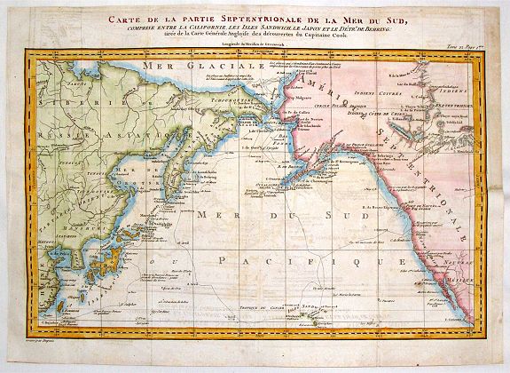
“Carte de la Partie Septentrionale de la Mer du Sud, Comprise entre La Californie, Les Isles Sandwich, Le Japon et le Detroit de Behring”
Map Maker:
Dupuis
An informative Cook's map of the Pacific Ocean wit... (full text available to subscribers)
| Item Detail |
| |
| |
MapMaker: |
Dupuis
|
|
| |
| |
Subject: |
North Pacific Ocean |
|
| |
Period/Size: |
c. 1795 / 10.2" x 14.4" (26.0 x 36.5 cm)
|
|
| |
Color: |
Colored
|
|
| |
Condition: |
In fair condition with the top right side re-margined to replace the hinge where it attached to the book. The once multi-folded map has been flattened using old paper. A tear on the right has been repaired. (condition help) |
|
| |
Source: |
|
|
| |
References: |
|
|
| |
|
|
| Sales Information |
| |
| |
Price: |
|
|
| |
| |
Offered by: |
Paulus Swaen Old Maps & Prints |
|
| |
Catalog: |
September 18, 2018 - Internet Auction (9437) |
|
| |
Lot/Item #: |
93117 |
|
| |
| |
Date: |
09/2018
|
|
| |
| |
|
Antique Maps - Valuation and Pricing, Descriptions, Resources |
|
Home |
Information |
Search |
Register |
Contact Us |
Site Map
Americana Exchange, Inc. © 1999 - 2024 Americana Exchange, Inc.. All rights reserved.
OldMaps.com, the OldMaps.com logo and
AMPR are service marks or registered service marks of Americana Exchange, Inc..
|