| Item Detail |
| |
| |
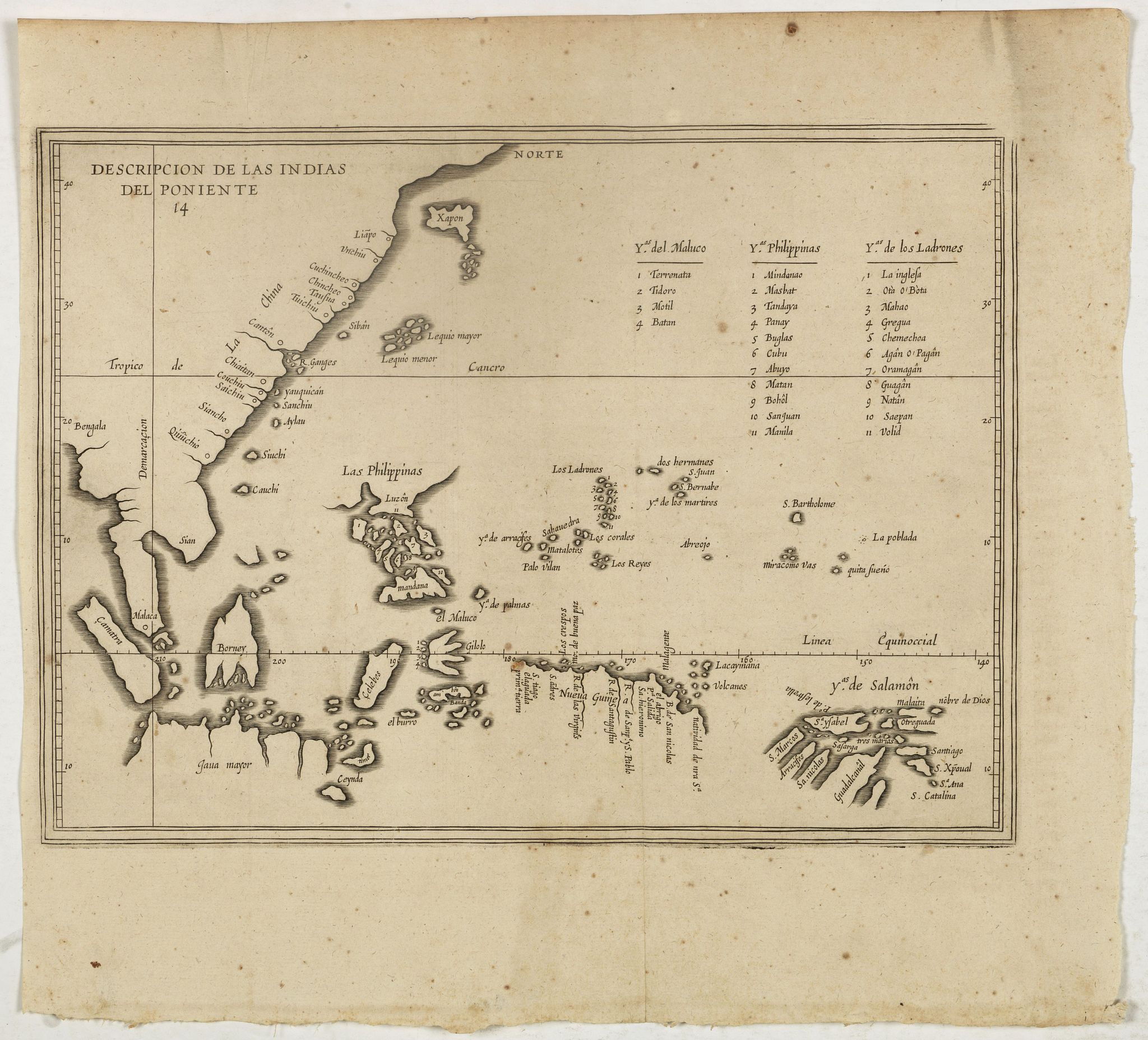
MapMaker: |
Antonio de Herrera y Tordesillas
|
|
| |
| |
Subject: |
Southeast Asia |
|
| |
Period/Size: |
1622 / 8.4" x 11.4" (21.3 x 29.0 cm)
|
|
| |
Color: |
Black & White
|
|
| |
Condition: |
Paper very slightly age toned as usual. A very good and dark impression. (condition help) |
|
| |
Source: |
Description des Indes Occidentales… |
|
| |
References: |
Hayes, Historical Atlas of the North Pacific Ocean, p. 18 (Plate 16). Suarez, Early Mapping of Southeast Asia, pp. 172-173. Vindel, Mapas de America en los Libros Espańoles, Plate 89-90. |
|
| |
|
|
| Sales Information |
| |
| |
Price: |
|
|
| |
| |
Offered by: |
Paulus Swaen Old Maps & Prints |
|
| |
Catalog: |
September 18, 2018 - Internet Auction (9437) |
|
| |
Lot/Item #: |
39666 |
|
| |
| |
Date: |
09/2018
|
|
| |
| |
|