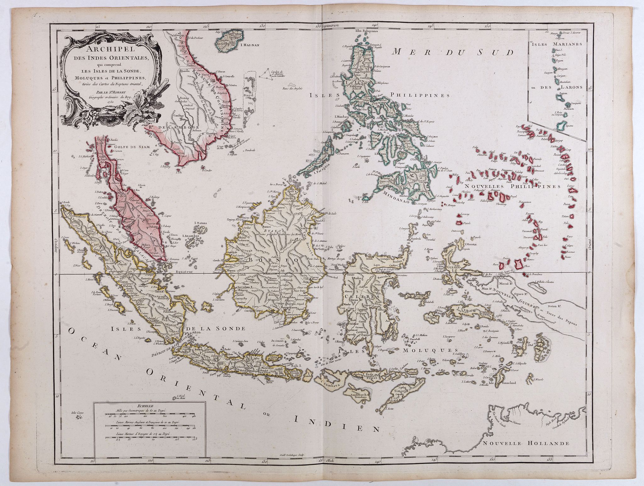
Title:
“Archipel des Indes Orientales, qui Comprend les Isles de la Sonde, Moluques et Philippines…”
Map Maker:
Robert de Vaugondy [Family]
An attractive and detailed view of the Indonesian ... (full text available to subscribers)
| Item Detail |
| |
| |
MapMaker: |
Robert de Vaugondy [Family]
|
|
| |
| |
Subject: |
East Indies - Indonesia & Philippines |
|
| |
Period/Size: |
1750 / 18.9" x 23.1" (48.0 x 58.8 cm)
|
|
| |
Color: |
Colored
|
|
| |
Condition: |
In fine condition. In original o/l colours. (condition help) |
|
| |
Source: |
Atlas Universel |
|
| |
References: |
|
|
| |
|
|
| Sales Information |
| |
| |
Price: |
|
|
| |
| |
Offered by: |
Paulus Swaen Old Maps & Prints |
|
| |
Catalog: |
September 18, 2018 - Internet Auction (9437) |
|
| |
Lot/Item #: |
40671 |
|
| |
| |
Date: |
09/2018
|
|
| |
| |
|
Antique Maps - Valuation and Pricing, Descriptions, Resources |
|
Home |
Information |
Search |
Register |
Contact Us |
Site Map
Americana Exchange, Inc. © 1999 - 2024 Americana Exchange, Inc.. All rights reserved.
OldMaps.com, the OldMaps.com logo and
AMPR are service marks or registered service marks of Americana Exchange, Inc..
|