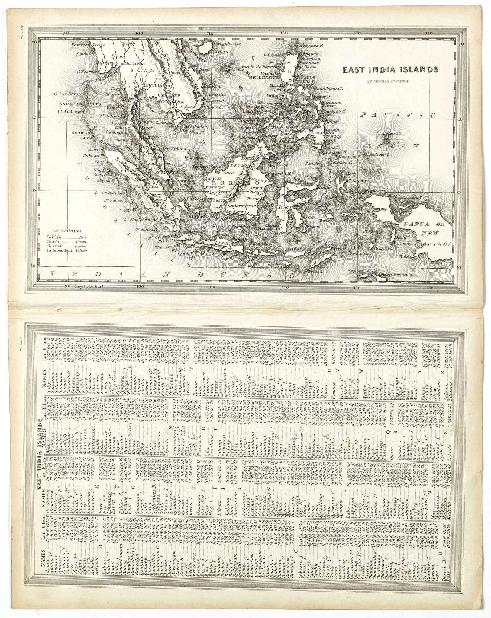
Title:
“East India Islands”
Map Maker:
Thomas Starling
A detailed miniature map with a full-page table of... (full text available to subscribers)
| Item Detail |
| |
| |
MapMaker: |
Thomas Starling
|
|
| |
| |
Subject: |
East Indies - Indonesia |
|
| |
Period/Size: |
c. 1835 / 3.5" x 5.8" (9.0 x 14.7 cm)
|
|
| |
Color: |
Colored
|
|
| |
Condition: |
Very good example. Some toning to margins. In original o/l colours. (condition help) |
|
| |
Source: |
The Royal Cabinet Atlas & Universal Compendium… |
|
| |
References: |
|
|
| |
|
|
| Sales Information |
| |
| |
Price: |
|
|
| |
| |
Offered by: |
Paulus Swaen Old Maps & Prints |
|
| |
Catalog: |
September 18, 2018 - Internet Auction (9437) |
|
| |
Lot/Item #: |
42259 |
|
| |
| |
Date: |
09/2018
|
|
| |
| |
|
Antique Maps - Valuation and Pricing, Descriptions, Resources |
|
Home |
Information |
Search |
Register |
Contact Us |
Site Map
Americana Exchange, Inc. © 1999 - 2024 Americana Exchange, Inc.. All rights reserved.
OldMaps.com, the OldMaps.com logo and
AMPR are service marks or registered service marks of Americana Exchange, Inc..
|