Title:
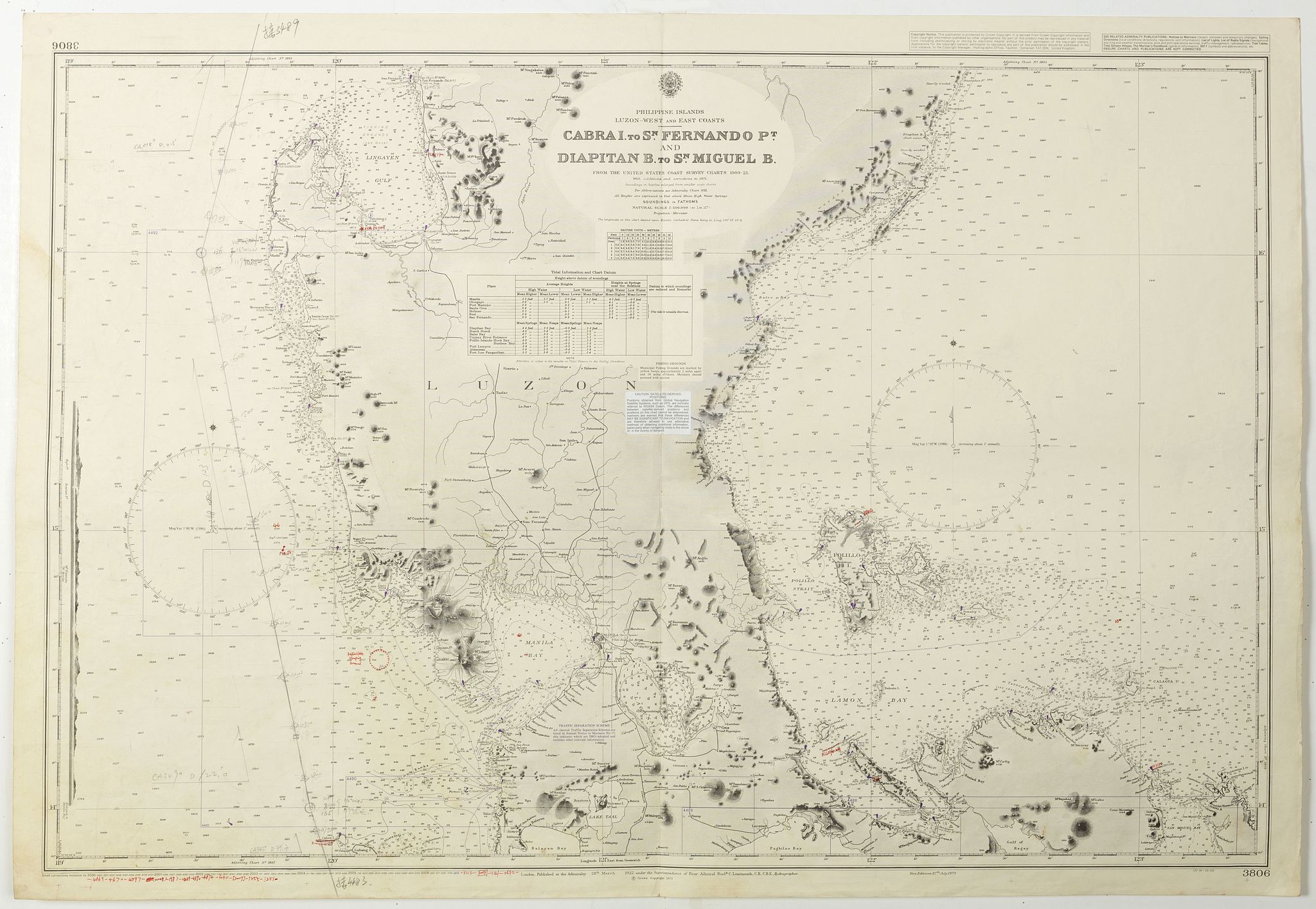
“Philippine Islands - Luzon - west and east coast. Cabra I. to S.n Fernando P.t. Diapitan B. to S.n Miguel B. . . (3806)”
Map Maker:
British Admiralty
Detailed chart of Luzon Island with Manilla Bay, C... (full text available to subscribers)
| Item Detail |
| |
| |
MapMaker: |
British Admiralty
|
|
| |
| |
Subject: |
Philippines |
|
| |
Period/Size: |
2006 / 24.9" x 38.6" (63.3 x 98.0 cm)
|
|
| |
Color: |
Colored
|
|
| |
Condition: |
Paper slightly age toned with slight signs of use. Small tear of lower part center fold. Good condition. With corrections in red, blue and purple ink and lead pencil. Small paste on label. (condition help) |
|
| |
Source: |
|
|
| |
References: |
|
|
| |
|
|
| Sales Information |
| |
| |
Price: |
|
|
| |
| |
Offered by: |
Paulus Swaen Old Maps & Prints |
|
| |
Catalog: |
September 18, 2018 - Internet Auction (9437) |
|
| |
Lot/Item #: |
42285 |
|
| |
| |
Date: |
09/2018
|
|
| |
| |
|
Antique Maps - Valuation and Pricing, Descriptions, Resources |
|
Home |
Information |
Search |
Register |
Contact Us |
Site Map
Americana Exchange, Inc. © 1999 - 2024 Americana Exchange, Inc.. All rights reserved.
OldMaps.com, the OldMaps.com logo and
AMPR are service marks or registered service marks of Americana Exchange, Inc..
|