| Item Detail |
| |
| |
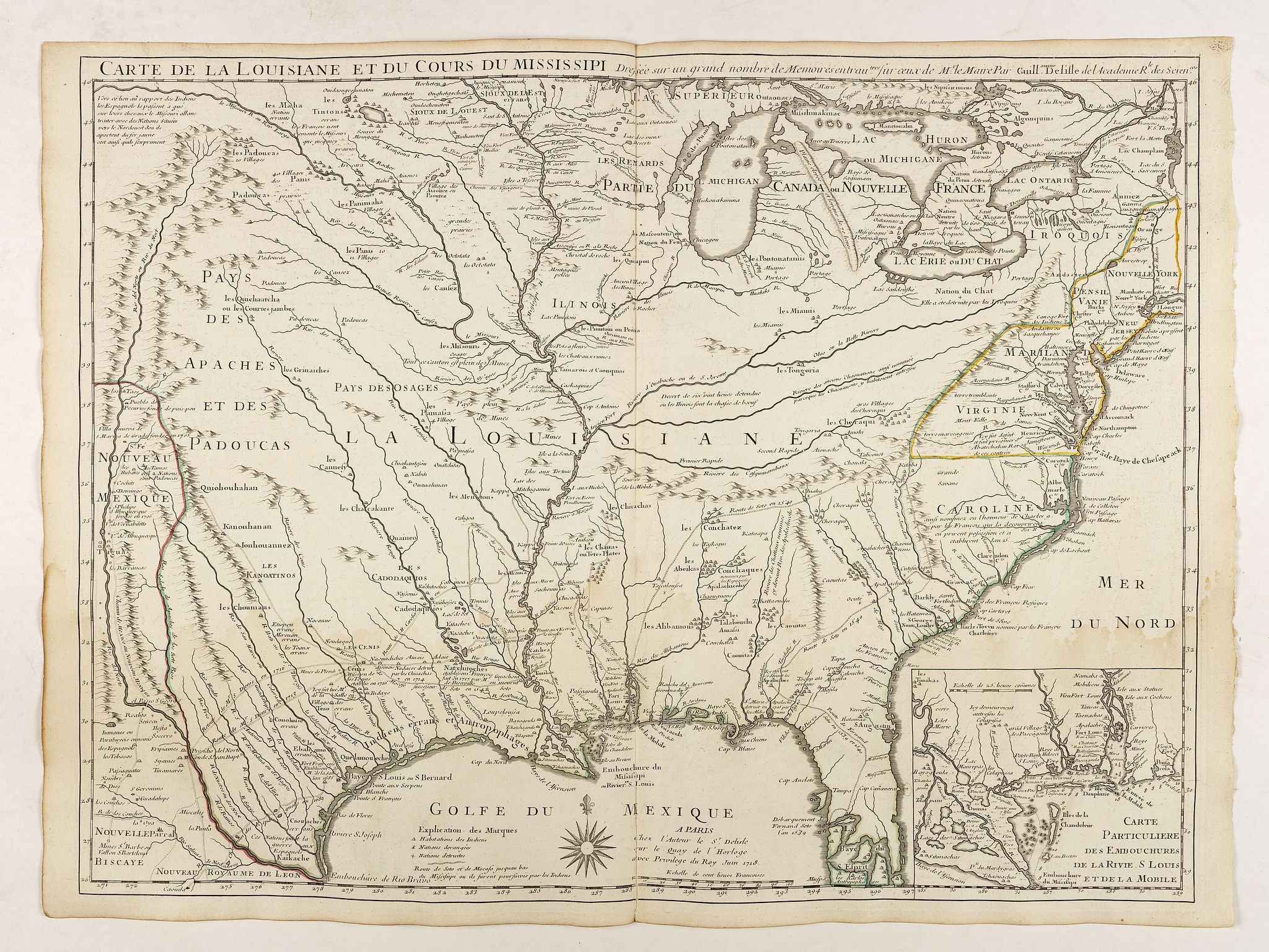
MapMaker: |
Guillaume Delisle
|
|
| |
| |
Subject: |
Eastern United States |
|
| |
Period/Size: |
1718 / 19.1" x 25.6" (48.5 x 65.0 cm)
|
|
| |
Color: |
Colored
|
|
| |
Condition: |
In original o/l colours. Printed on heavy paper, good and dark impression. Slightly water staining in lower part of the map. (condition help) |
|
| |
Source: |
|
|
| |
References: |
Cumming, 170., Tooley, Mapping of America, 43., Wheat, 99., Paullin and Wright, 24, Martin, 19., Lowery, 269, Kohl, 238., P-Maps, p. 437-438. |
|
| |
|
|
| Sales Information |
| |
| |
Price: |
|
|
| |
| |
Offered by: |
Paulus Swaen Old Maps & Prints |
|
| |
Catalog: |
October 16, 2018 - Internet Auction (9440) |
|
| |
Lot/Item #: |
41868 |
|
| |
| |
Date: |
10/2018
|
|
| |
| |
|