Title:
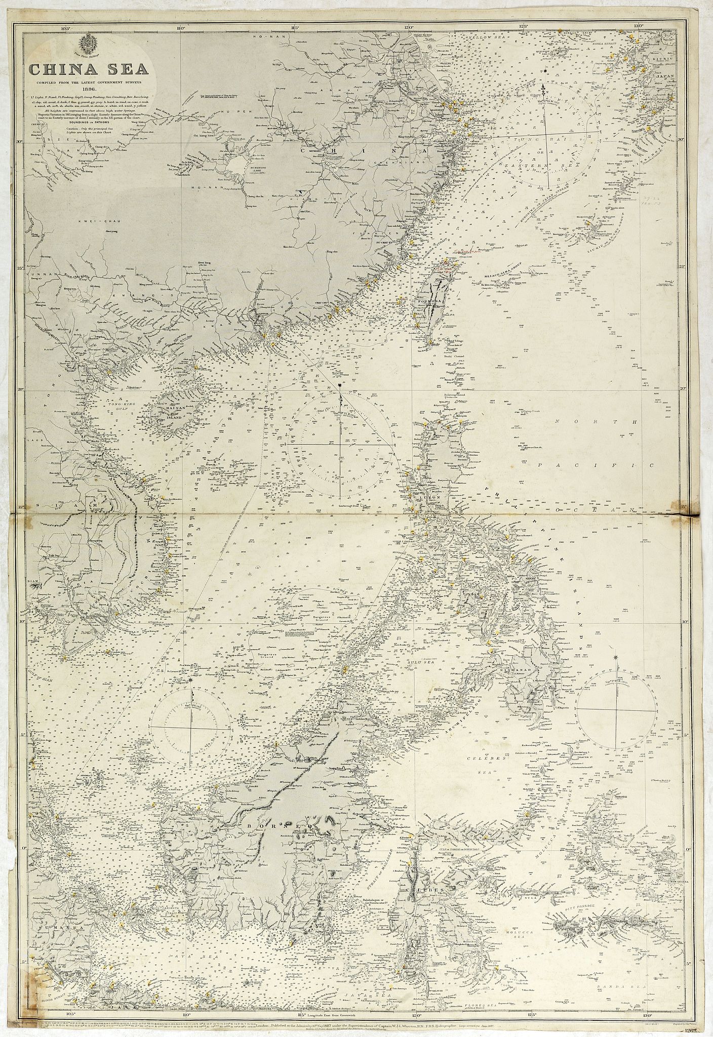
“China sea compiled from the latest government surveys 1886”
Map Maker:
British Admiralty
Detailed sea chart of the "China Sea", first publi... (full text available to subscribers)
| Item Detail |
| |
| |
MapMaker: |
British Admiralty
|
|
| |
| |
Subject: |
Eastern Asia |
|
| |
Period/Size: |
1913 / 39.6" x 26.4" (100.5 x 67.0 cm)
|
|
| |
Color: |
Colored
|
|
| |
Condition: |
Light houses coloured with yellow/red dots. A few minor light brown spots. Center fold thin, repaired lower left corner, with some browning due to old repair. Generally good for a chart. (condition help) |
|
| |
Source: |
|
|
| |
References: |
|
|
| |
|
|
| Sales Information |
| |
| |
Price: |
|
|
| |
| |
Offered by: |
Paulus Swaen Old Maps & Prints |
|
| |
Catalog: |
October 16, 2018 - Internet Auction (9440) |
|
| |
Lot/Item #: |
42615 |
|
| |
| |
Date: |
10/2018
|
|
| |
| |
|
Antique Maps - Valuation and Pricing, Descriptions, Resources |
|
Home |
Information |
Search |
Register |
Contact Us |
Site Map
Americana Exchange, Inc. © 1999 - 2024 Americana Exchange, Inc.. All rights reserved.
OldMaps.com, the OldMaps.com logo and
AMPR are service marks or registered service marks of Americana Exchange, Inc..
|