Title:
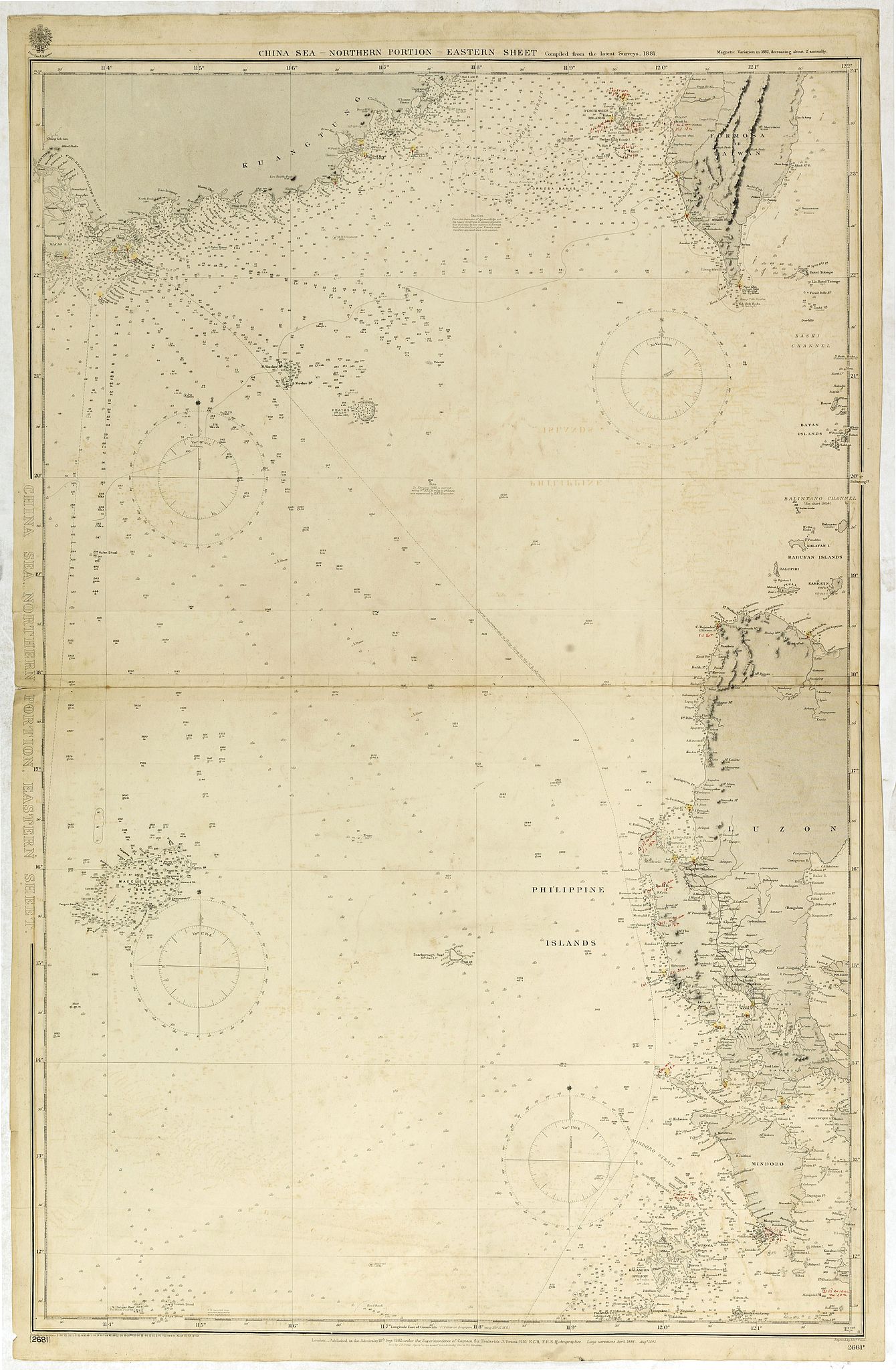
“China Sea Northen portion - Eastern sheetCompiled from the latest Surveys 1881”
Map Maker:
British Admiralty
Huge sailing chart showing the China Sea covering ... (full text available to subscribers)
| Item Detail |
| |
| |
MapMaker: |
British Admiralty
|
|
| |
| |
Subject: |
Eastern Asia |
|
| |
Period/Size: |
1913 / 38.2" x 25.2" (97.0 x 64.0 cm)
|
|
| |
Color: |
Colored
|
|
| |
Condition: |
Light houses heightened with yellow/red dots. With annotations/corrections in red ink. A few minor light brown spots. Generally very good for a working chart. (condition help) |
|
| |
Source: |
|
|
| |
References: |
|
|
| |
|
|
| Sales Information |
| |
| |
Price: |
|
|
| |
| |
Offered by: |
Paulus Swaen Old Maps & Prints |
|
| |
Catalog: |
October 16, 2018 - Internet Auction (9440) |
|
| |
Lot/Item #: |
42616 |
|
| |
| |
Date: |
10/2018
|
|
| |
| |
|
Antique Maps - Valuation and Pricing, Descriptions, Resources |
|
Home |
Information |
Search |
Register |
Contact Us |
Site Map
Americana Exchange, Inc. © 1999 - 2024 Americana Exchange, Inc.. All rights reserved.
OldMaps.com, the OldMaps.com logo and
AMPR are service marks or registered service marks of Americana Exchange, Inc..
|