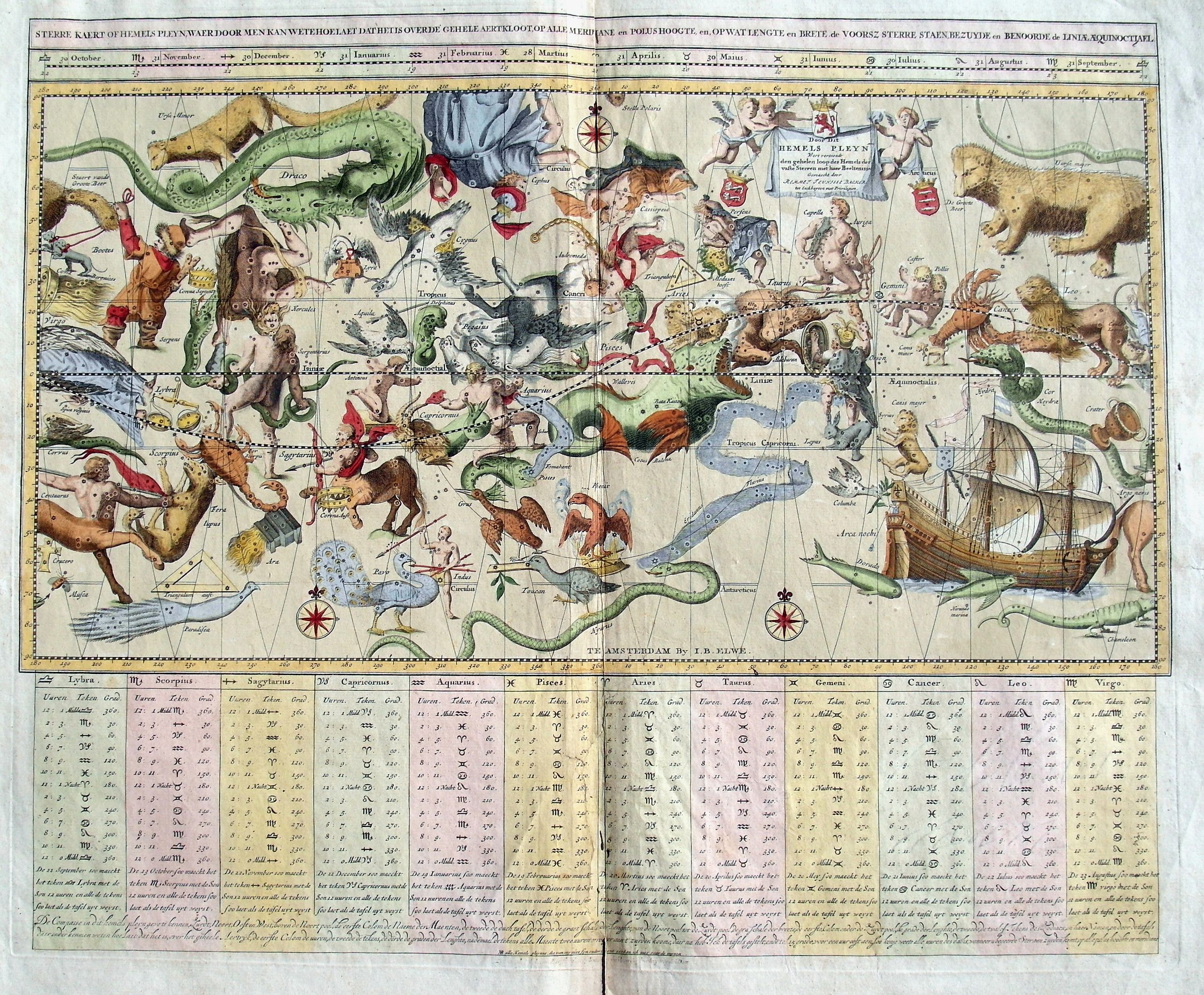
Title:
“Sterre Kaert of Hemels Pleyn. . .”
Map Maker:
Jan Barend Elwe
A fantastic 18th century copper engraved map. This... (full text available to subscribers)
| Item Detail |
| |
| |
MapMaker: |
Jan Barend Elwe
|
|
| |
| |
Subject: |
Celestial |
|
| |
Period/Size: |
1792 / 18.5" x 22.0" (47.0 x 56.0 cm)
|
|
| |
Color: |
Colored
|
|
| |
Condition: |
Good impression. With faint soiling and overall toning. Creasing to central fold with a repair on the lower fold area. Hand laid and watermarked paper with good margins. A few short repaired tears to the paper edges. (condition help) |
|
| |
Source: |
|
|
| |
References: |
|
|
| |
|
|
| Sales Information |
| |
| |
Price: |
|
|
| |
| |
Offered by: |
Paulus Swaen Old Maps & Prints |
|
| |
Catalog: |
October 16, 2018 - Internet Auction (9440) |
|
| |
Lot/Item #: |
82064 |
|
| |
| |
Date: |
10/2018
|
|
| |
| |
|
Antique Maps - Valuation and Pricing, Descriptions, Resources |
|
Home |
Information |
Search |
Register |
Contact Us |
Site Map
Americana Exchange, Inc. © 1999 - 2024 Americana Exchange, Inc.. All rights reserved.
OldMaps.com, the OldMaps.com logo and
AMPR are service marks or registered service marks of Americana Exchange, Inc..
|