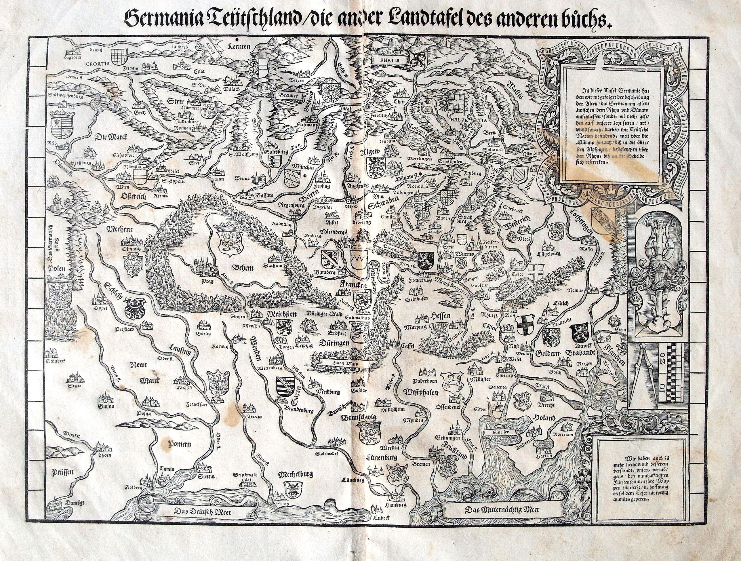
Title:
“Germania Teutschland/die ander Landtafel des anderen Buchs”
Map Maker:
Johannes Stumpf
An early woodcut printed map. The fantastic map sh... (full text available to subscribers)
| Item Detail |
| |
| |
MapMaker: |
Johannes Stumpf
|
|
| |
| |
Subject: |
Germany |
|
| |
Period/Size: |
c. 1550 / 10.9" x 15.3" (27.7 x 38.9 cm)
|
|
| |
Color: |
Black & White
|
|
| |
Condition: |
A good dark print. Wide margins with some defects to paper edges. Some staining. Central fold with long repaired tear and three small worming holes. A further four small holes inside the map. (condition help) |
|
| |
Source: |
|
|
| |
References: |
|
|
| |
|
|
| Sales Information |
| |
| |
Price: |
|
|
| |
| |
Offered by: |
Paulus Swaen Old Maps & Prints |
|
| |
Catalog: |
October 16, 2018 - Internet Auction (9440) |
|
| |
Lot/Item #: |
82048 |
|
| |
| |
Date: |
10/2018
|
|
| |
| |
|
Antique Maps - Valuation and Pricing, Descriptions, Resources |
|
Home |
Information |
Search |
Register |
Contact Us |
Site Map
Americana Exchange, Inc. © 1999 - 2024 Americana Exchange, Inc.. All rights reserved.
OldMaps.com, the OldMaps.com logo and
AMPR are service marks or registered service marks of Americana Exchange, Inc..
|