Title:
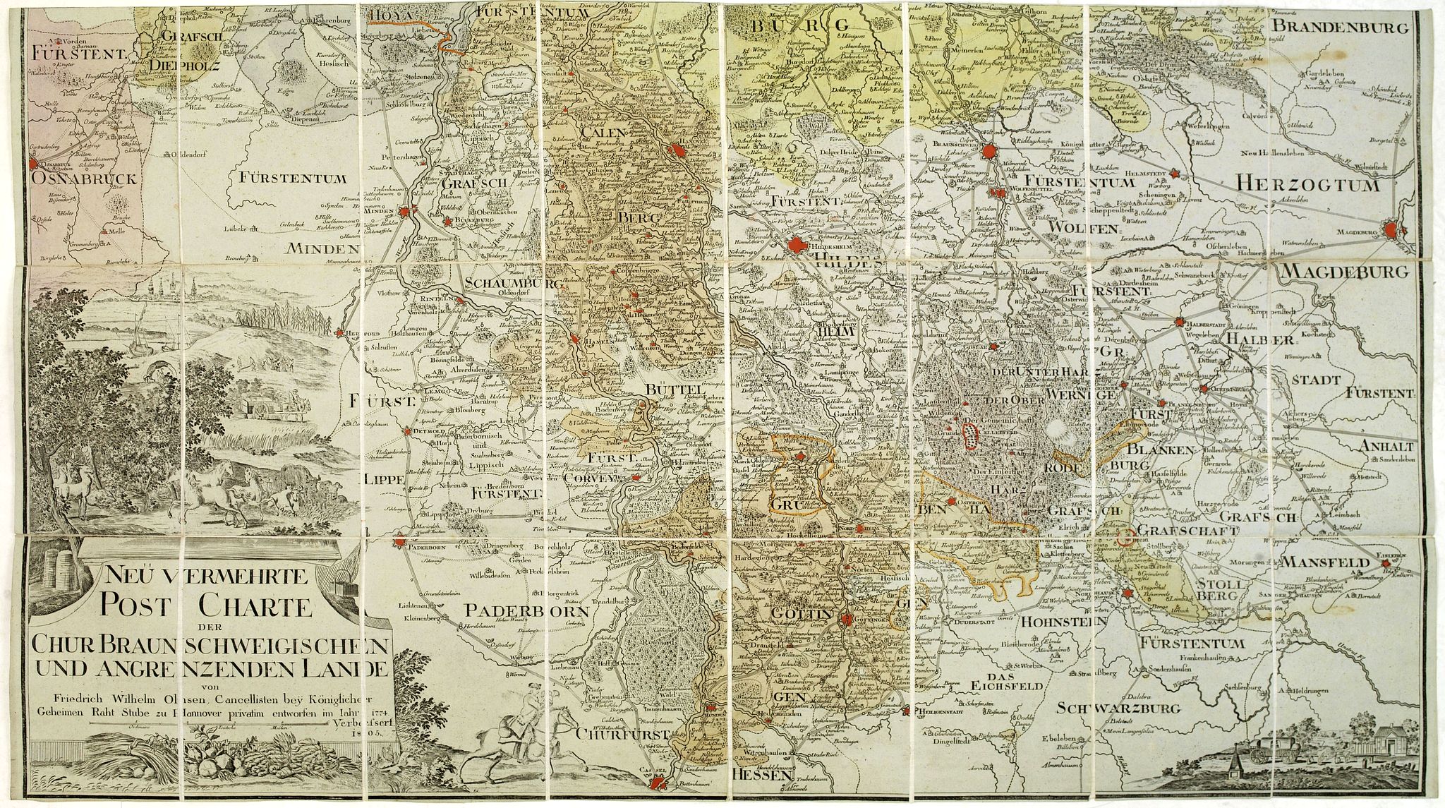
“Neu vermehrte post charte der chur Braunschweigischen und angrenzenden lande. . . Von Friedrich Wilhelm Ohsen, … privatim entworfen im Jahre 1774, verbessert 1805”
Map Maker:
Friederich Wilhelm Ohsen
Folding-map dissected in 24 sections, canvas mount... (full text available to subscribers)
| Item Detail |
| |
| |
MapMaker: |
Friederich Wilhelm Ohsen
|
|
| |
| |
Subject: |
Germany |
|
| |
Period/Size: |
1805 / 20.9" x 37.0" (53.1 x 94.0 cm)
|
|
| |
Color: |
Colored
|
|
| |
Condition: |
In original colours. (condition help) |
|
| |
Source: |
|
|
| |
References: |
|
|
| |
|
|
| Sales Information |
| |
| |
Price: |
|
|
| |
| |
Offered by: |
Paulus Swaen Old Maps & Prints |
|
| |
Catalog: |
October 16, 2018 - Internet Auction (9440) |
|
| |
Lot/Item #: |
30631 |
|
| |
| |
Date: |
10/2018
|
|
| |
| |
|
Antique Maps - Valuation and Pricing, Descriptions, Resources |
|
Home |
Information |
Search |
Register |
Contact Us |
Site Map
Americana Exchange, Inc. © 1999 - 2024 Americana Exchange, Inc.. All rights reserved.
OldMaps.com, the OldMaps.com logo and
AMPR are service marks or registered service marks of Americana Exchange, Inc..
|