Title:
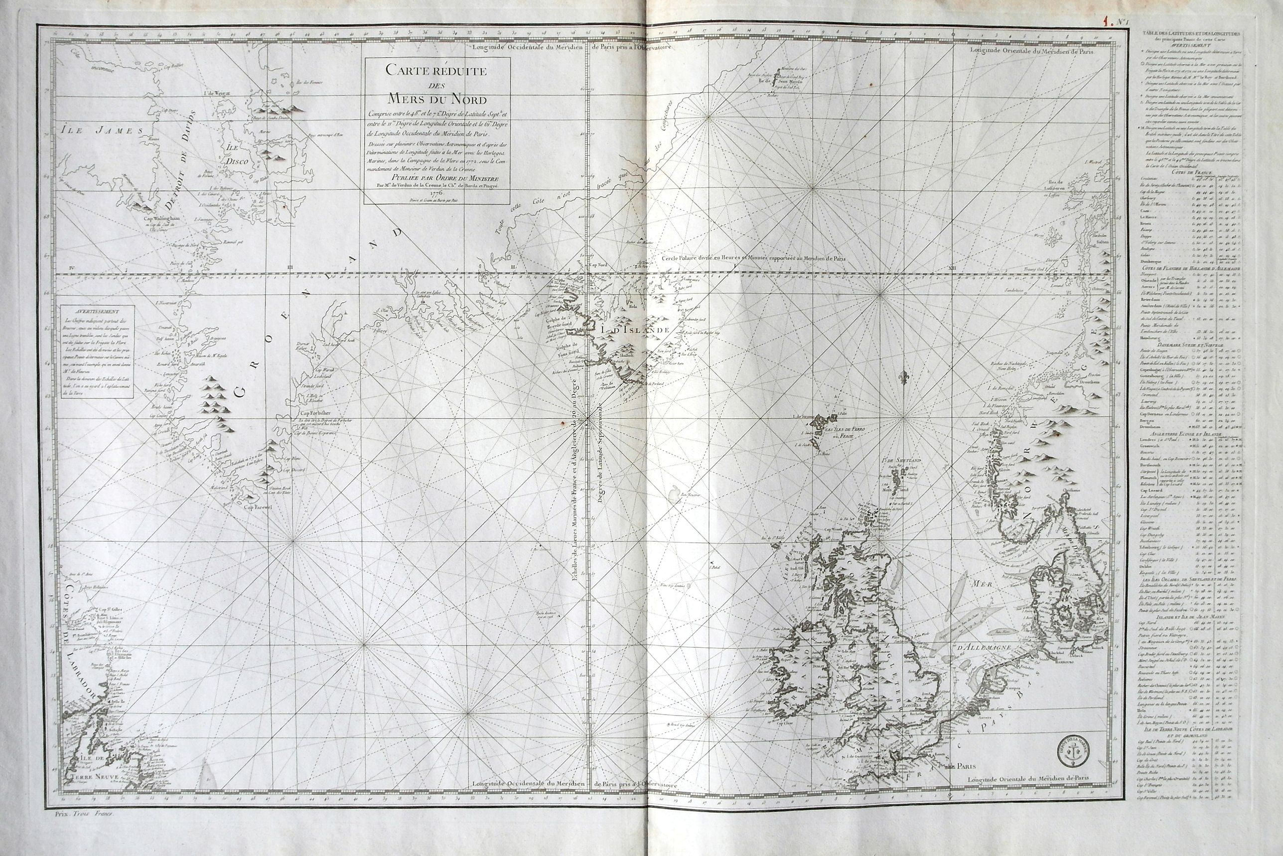
“Carte Réduite des Mers du Nord . . .”
Map Maker:
Jacques Nicolas Bellin
A highly interesting large-scale sea chart of the ... (full text available to subscribers)
| Item Detail |
| |
| |
MapMaker: |
Jacques Nicolas Bellin
|
|
| |
| |
Subject: |
North Sea |
|
| |
Period/Size: |
1776 / 22.0" x 34.3" (55.9 x 87.2 cm)
|
|
| |
Color: |
Black & White
|
|
| |
Condition: |
A very good example with dark print on heavy paper with large real watermarks. Faint offsetting. Light soiling to the central fold. Wide margins with some staining to the top. A few small brown spots. (condition help) |
|
| |
Source: |
|
|
| |
References: |
|
|
| |
|
|
| Sales Information |
| |
| |
Price: |
|
|
| |
| |
Offered by: |
Paulus Swaen Old Maps & Prints |
|
| |
Catalog: |
October 16, 2018 - Internet Auction (9440) |
|
| |
Lot/Item #: |
82072 |
|
| |
| |
Date: |
10/2018
|
|
| |
| |
|
Antique Maps - Valuation and Pricing, Descriptions, Resources |
|
Home |
Information |
Search |
Register |
Contact Us |
Site Map
Americana Exchange, Inc. © 1999 - 2024 Americana Exchange, Inc.. All rights reserved.
OldMaps.com, the OldMaps.com logo and
AMPR are service marks or registered service marks of Americana Exchange, Inc..
|