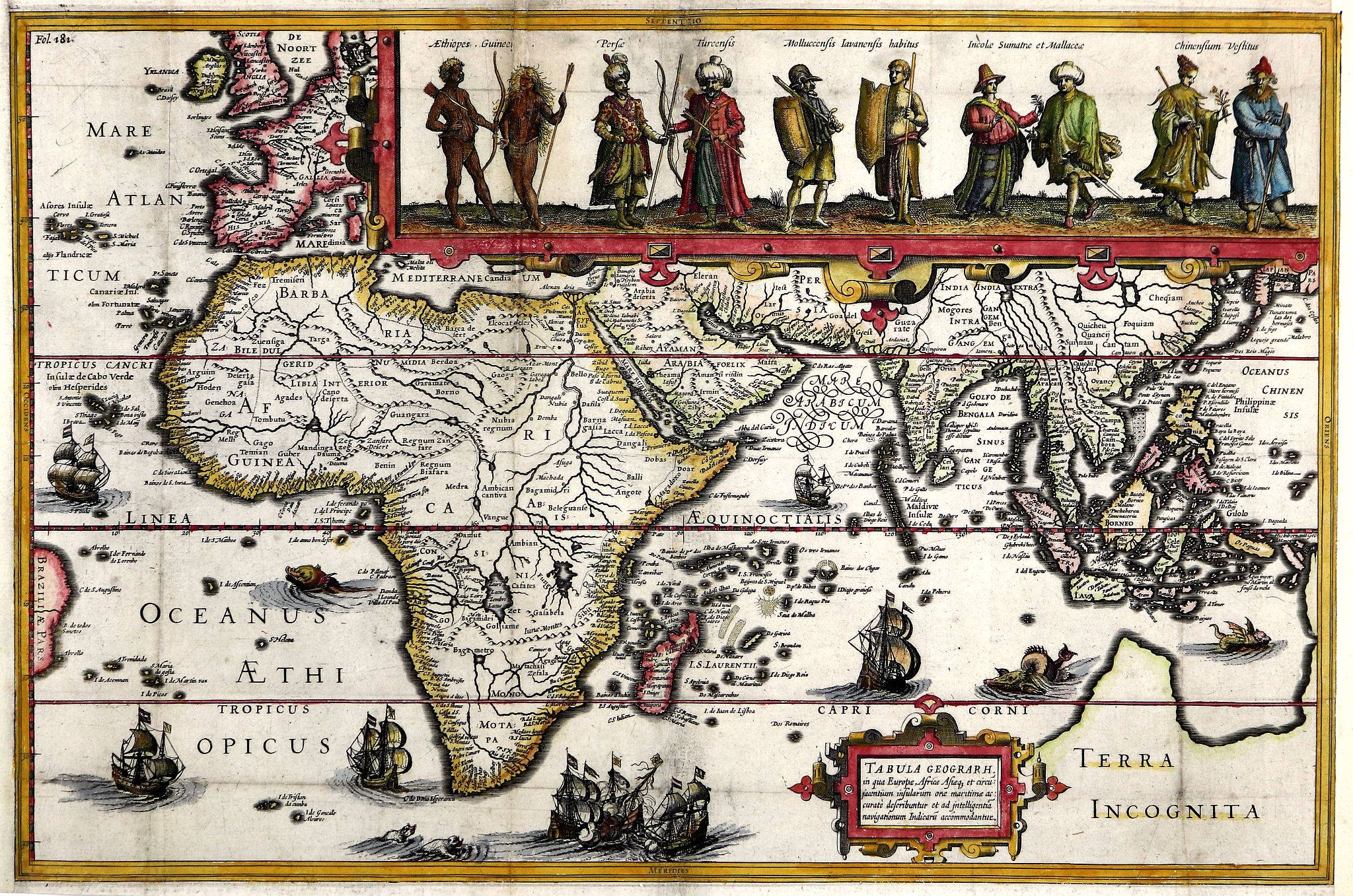
Title:
“Tabula Geograph in qua Europa, Africa, Asiaq. et Circumiacentium Insularum Ora Maritima Accurata Describuntur …”
Map Maker:
Jodocus Hondius
In 1611 Isaac Pontanus, published his “Rerum et ur... (full text available to subscribers)
| Item Detail |
| |
| |
MapMaker: |
Jodocus Hondius
|
|
| |
| |
Subject: |
Eastern Hemisphere |
|
| |
Period/Size: |
1614 / 10.9" x 16.6" (27.7 x 42.2 cm)
|
|
| |
Color: |
Colored
|
|
| |
Condition: |
Fine colouring, clear and sharp impression. Folding lines as issued. Restored added margins. Some browning and wrinkling. Verso blanc and partially reinforced with Chinese paper. (condition help) |
|
| |
Source: |
Historische beschrijvinghe der seer wijt beroemde coop-stadt Amsterdam |
|
| |
References: |
|
|
| |
|
|
| Sales Information |
| |
| |
Price: |
|
|
| |
| |
Offered by: |
Paulus Swaen Old Maps & Prints |
|
| |
Catalog: |
February 19, 2019 - Internet Auction (9452) |
|
| |
Lot/Item #: |
43251 |
|
| |
| |
Date: |
02/2019
|
|
| |
| |
|
Antique Maps - Valuation and Pricing, Descriptions, Resources |
|
Home |
Information |
Search |
Register |
Contact Us |
Site Map
Americana Exchange, Inc. © 1999 - 2024 Americana Exchange, Inc.. All rights reserved.
OldMaps.com, the OldMaps.com logo and
AMPR are service marks or registered service marks of Americana Exchange, Inc..
|