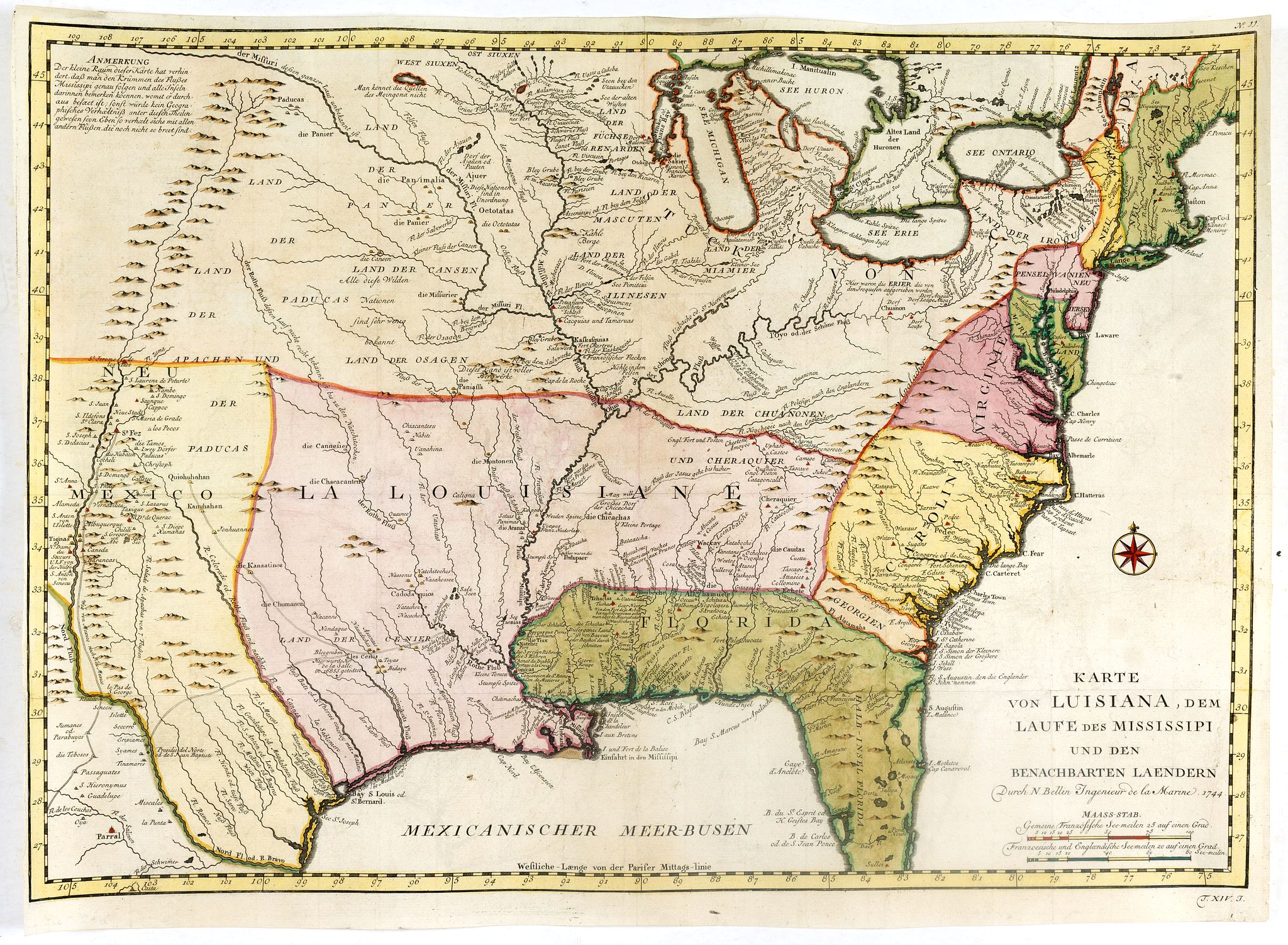
Title:
“Karte von Luisiana, dem Laufe des Mississipi und den Benachbarten Laendern”
Map Maker:
Jacques Nicolas Bellin
Published: Leipzig, Arkstee & Merkus, 1746
A r... (full text available to subscribers)
| Item Detail |
| |
| |
MapMaker: |
Jacques Nicolas Bellin
|
|
| |
| |
Subject: |
Eastern United States |
|
| |
Period/Size: |
1746 / 15.6" x 13.1" (39.7 x 33.3 cm)
|
|
| |
Color: |
Colored
|
|
| |
Condition: |
Several foldings as issued. In center part of the map several small holes filled in. Short margins. Good and dark impression. (condition help) |
|
| |
Source: |
|
|
| |
References: |
|
|
| |
|
|
| Sales Information |
| |
| |
Price: |
|
|
| |
| |
Offered by: |
Paulus Swaen Old Maps & Prints |
|
| |
Catalog: |
February 19, 2019 - Internet Auction (9452) |
|
| |
Lot/Item #: |
36562 |
|
| |
| |
Date: |
02/2019
|
|
| |
| |
|
Antique Maps - Valuation and Pricing, Descriptions, Resources |
|
Home |
Information |
Search |
Register |
Contact Us |
Site Map
Americana Exchange, Inc. © 1999 - 2024 Americana Exchange, Inc.. All rights reserved.
OldMaps.com, the OldMaps.com logo and
AMPR are service marks or registered service marks of Americana Exchange, Inc..
|