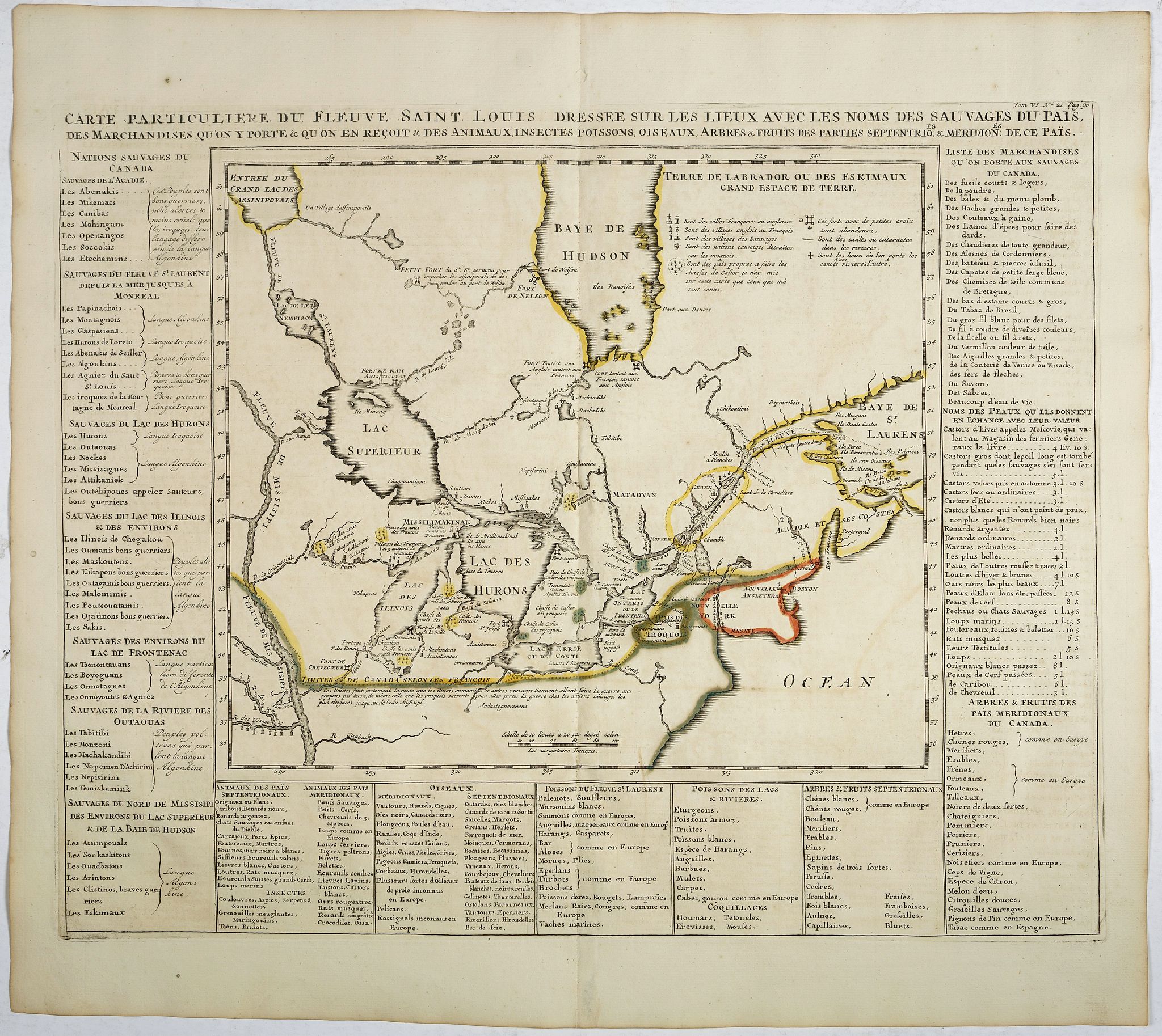
Title:
“Carte Particuliere du Fleuve Saint Louis Dressee sur les lieux avec les noms des sauvages du pais…”
Map Maker:
Henry Abraham Chatelain
Map of the Great Lakes region, including the North... (full text available to subscribers)
| Item Detail |
| |
| |
MapMaker: |
Henry Abraham Chatelain
|
|
| |
| |
Subject: |
Canada & United States, Great Lakes |
|
| |
Period/Size: |
1720 / 14.4" x 17.7" (36.6 x 45.0 cm)
|
|
| |
Color: |
Colored
|
|
| |
Condition: |
Very good impression. Some minor paper thinning along the center fold. Rare to find in original colours. (condition help) |
|
| |
Source: |
|
|
| |
References: |
|
|
| |
|
|
| Sales Information |
| |
| |
Price: |
|
|
| |
| |
Offered by: |
Paulus Swaen Old Maps & Prints |
|
| |
Catalog: |
February 19, 2019 - Internet Auction (9452) |
|
| |
Lot/Item #: |
39043 |
|
| |
| |
Date: |
02/2019
|
|
| |
| |
|
Antique Maps - Valuation and Pricing, Descriptions, Resources |
|
Home |
Information |
Search |
Register |
Contact Us |
Site Map
Americana Exchange, Inc. © 1999 - 2024 Americana Exchange, Inc.. All rights reserved.
OldMaps.com, the OldMaps.com logo and
AMPR are service marks or registered service marks of Americana Exchange, Inc..
|