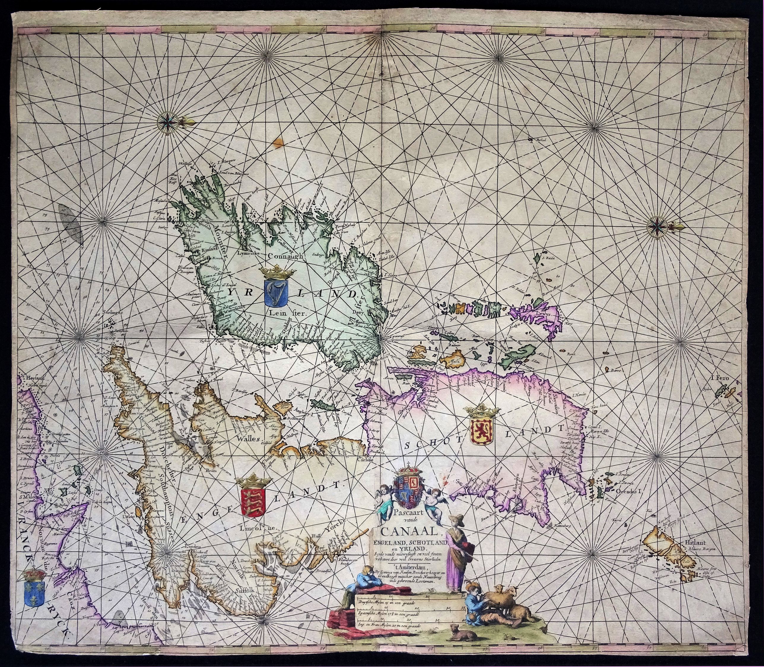
Title:
“Pascaart van de Canaal Engeland, Schotland en Yrland”
Map Maker:
Johannes van Keulen
A large nautical map of the complete British Isles... (full text available to subscribers)
| Item Detail |
| |
| |
MapMaker: |
Johannes van Keulen
|
|
| |
| |
Subject: |
Britain |
|
| |
Period/Size: |
c. 1680 / 20.9" x 23.8" (53.1 x 60.5 cm)
|
|
| |
Color: |
Colored
|
|
| |
Condition: |
Reasonable to good condition. The map shows some signs of usage, margins somewhat stained with several small repairs and reinforcements on the back. This has not affected the image. The print is bold and the colours are strong and vivid (condition help) |
|
| |
Source: |
|
|
| |
References: |
|
|
| |
|
|
| Sales Information |
| |
| |
Price: |
|
|
| |
| |
Offered by: |
Paulus Swaen Old Maps & Prints |
|
| |
Catalog: |
February 19, 2019 - Internet Auction (9452) |
|
| |
Lot/Item #: |
82250 |
|
| |
| |
Date: |
02/2019
|
|
| |
| |
|
Antique Maps - Valuation and Pricing, Descriptions, Resources |
|
Home |
Information |
Search |
Register |
Contact Us |
Site Map
Americana Exchange, Inc. © 1999 - 2024 Americana Exchange, Inc.. All rights reserved.
OldMaps.com, the OldMaps.com logo and
AMPR are service marks or registered service marks of Americana Exchange, Inc..
|