Title:
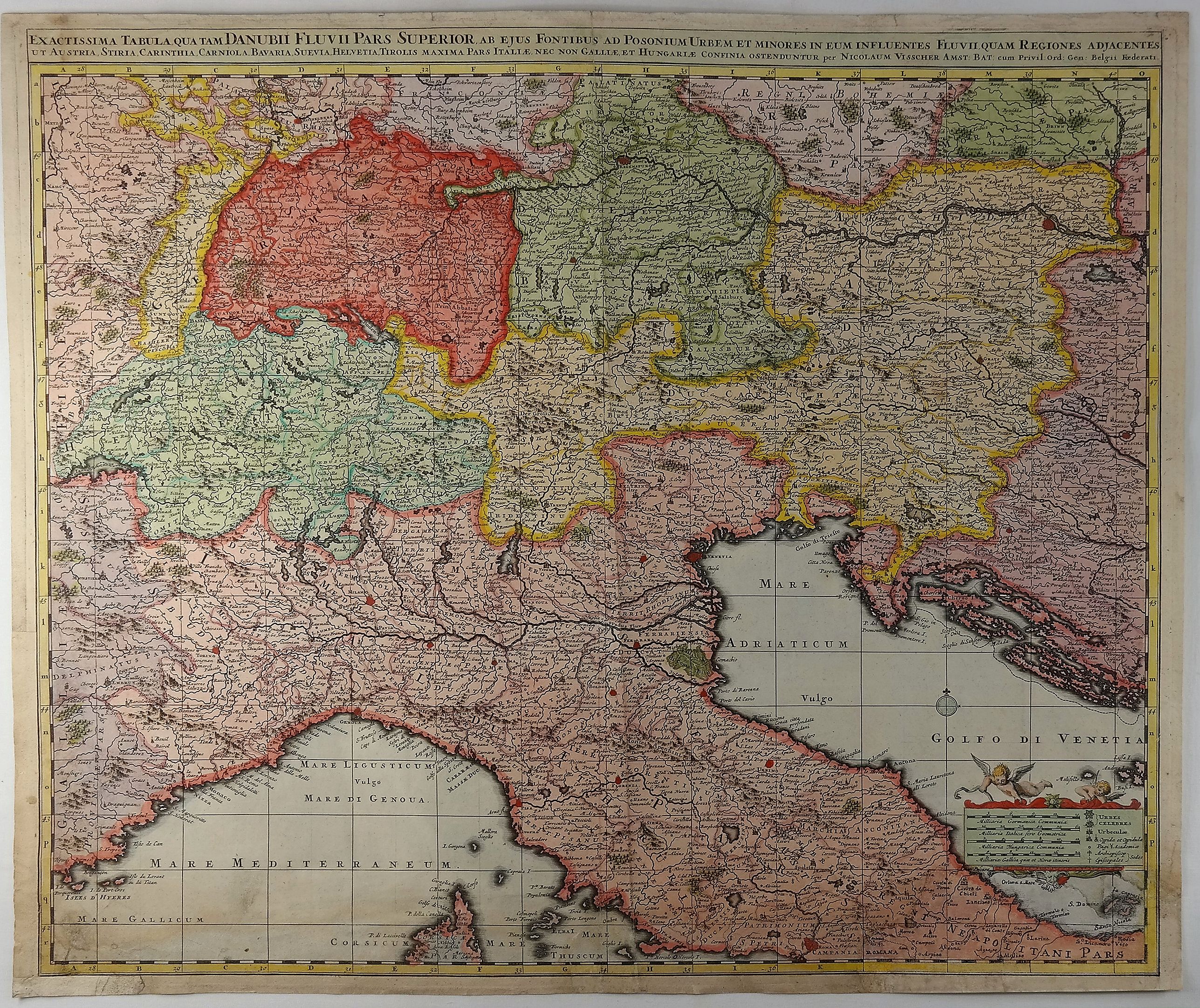
“Exactissima Tabula Qua Tam Danubii Fluvii Pars Superior …”
Map Maker:
Nicolas Visscher
A highly detailed map of the Upper Danube and the ... (full text available to subscribers)
| Item Detail |
| |
| |
MapMaker: |
Nicolas Visscher
|
|
| |
| |
Subject: |
Italy |
|
| |
Period/Size: |
1690 / 19.3" x 22.0" (49.1 x 55.9 cm)
|
|
| |
Color: |
Colored
|
|
| |
Condition: |
Original Colour. In fair condition with skillful repairs in the bottom corners and the bottom left margin replaced. (condition help) |
|
| |
Source: |
|
|
| |
References: |
|
|
| |
|
|
| Sales Information |
| |
| |
Price: |
|
|
| |
| |
Offered by: |
Paulus Swaen Old Maps & Prints |
|
| |
Catalog: |
February 19, 2019 - Internet Auction (9452) |
|
| |
Lot/Item #: |
82233 |
|
| |
| |
Date: |
02/2019
|
|
| |
| |
|
Antique Maps - Valuation and Pricing, Descriptions, Resources |
|
Home |
Information |
Search |
Register |
Contact Us |
Site Map
Americana Exchange, Inc. © 1999 - 2024 Americana Exchange, Inc.. All rights reserved.
OldMaps.com, the OldMaps.com logo and
AMPR are service marks or registered service marks of Americana Exchange, Inc..
|