Title:
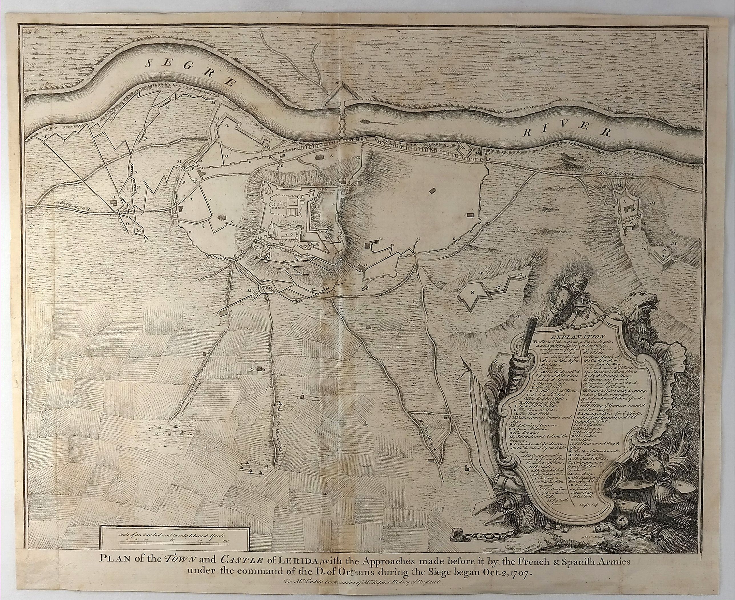
“Plan of the Town and Castle of Lerida, with the Approaches Made before it by the French & Spanish Armies under the Command of the D. of Orleans during the Siege Began Oct. 2, 1707”
Map Maker:
Isaac Basire
A striking plan of the siege of Lerida by the Bour... (full text available to subscribers)
| Item Detail |
| |
| |
MapMaker: |
Isaac Basire
|
|
| |
| |
Subject: |
Spain |
|
| |
Period/Size: |
1745 / 15.2" x 18.5" (38.6 x 47.0 cm)
|
|
| |
Color: |
Black & White
|
|
| |
Condition: |
In good condition with folds as issued. Several minor tears have been repaired and backed with Japan paper. (condition help) |
|
| |
Source: |
|
|
| |
References: |
|
|
| |
|
|
| Sales Information |
| |
| |
Price: |
|
|
| |
| |
Offered by: |
Paulus Swaen Old Maps & Prints |
|
| |
Catalog: |
February 19, 2019 - Internet Auction (9452) |
|
| |
Lot/Item #: |
82238 |
|
| |
| |
Date: |
02/2019
|
|
| |
| |
|
Antique Maps - Valuation and Pricing, Descriptions, Resources |
|
Home |
Information |
Search |
Register |
Contact Us |
Site Map
Americana Exchange, Inc. © 1999 - 2024 Americana Exchange, Inc.. All rights reserved.
OldMaps.com, the OldMaps.com logo and
AMPR are service marks or registered service marks of Americana Exchange, Inc..
|