Title:
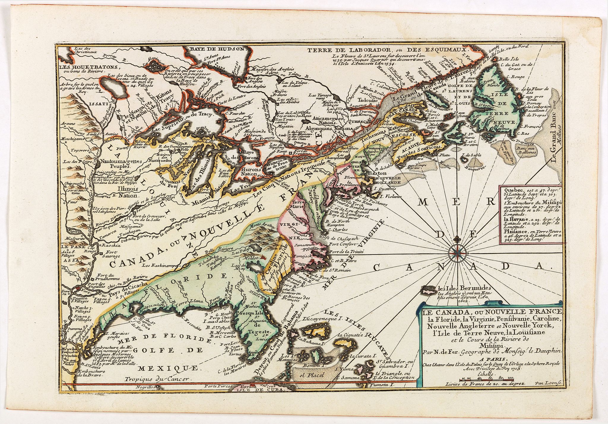
“Le Canada, ou Nouvelle France la Florida, la Virginie, Pensilvanie, Caroline, Nouvelle Angleterre et Nouvelle Yorck, l'Isle de Terre Neuve, la Louisiane et le Cours de la Riviere de Misisipi”
Map Maker:
Nicolas de Fer
Fine map is showing the east coast of the United S... (full text available to subscribers)
| Item Detail |
| |
| |
MapMaker: |
Nicolas de Fer
|
|
| |
| |
Subject: |
Canada & United States |
|
| |
Period/Size: |
1705 / 9.4" x 13.5" (23.9 x 34.3 cm)
|
|
| |
Color: |
Colored
|
|
| |
Condition: |
Paper very slightly age toned, water staining in the top right corner, otherwise in fine condition, dark impression.
Together with an engraved text sheet giving a description of the region in French. (condition help) |
|
| |
Source: |
|
|
| |
References: |
|
|
| |
|
|
| Sales Information |
| |
| |
Price: |
|
|
| |
| |
Offered by: |
Paulus Swaen Old Maps & Prints |
|
| |
Catalog: |
March 19, 2019 - Internet Auction (9460) |
|
| |
Lot/Item #: |
40848 |
|
| |
| |
Date: |
03/2019
|
|
| |
| |
|
Antique Maps - Valuation and Pricing, Descriptions, Resources |
|
Home |
Information |
Search |
Register |
Contact Us |
Site Map
Americana Exchange, Inc. © 1999 - 2024 Americana Exchange, Inc.. All rights reserved.
OldMaps.com, the OldMaps.com logo and
AMPR are service marks or registered service marks of Americana Exchange, Inc..
|