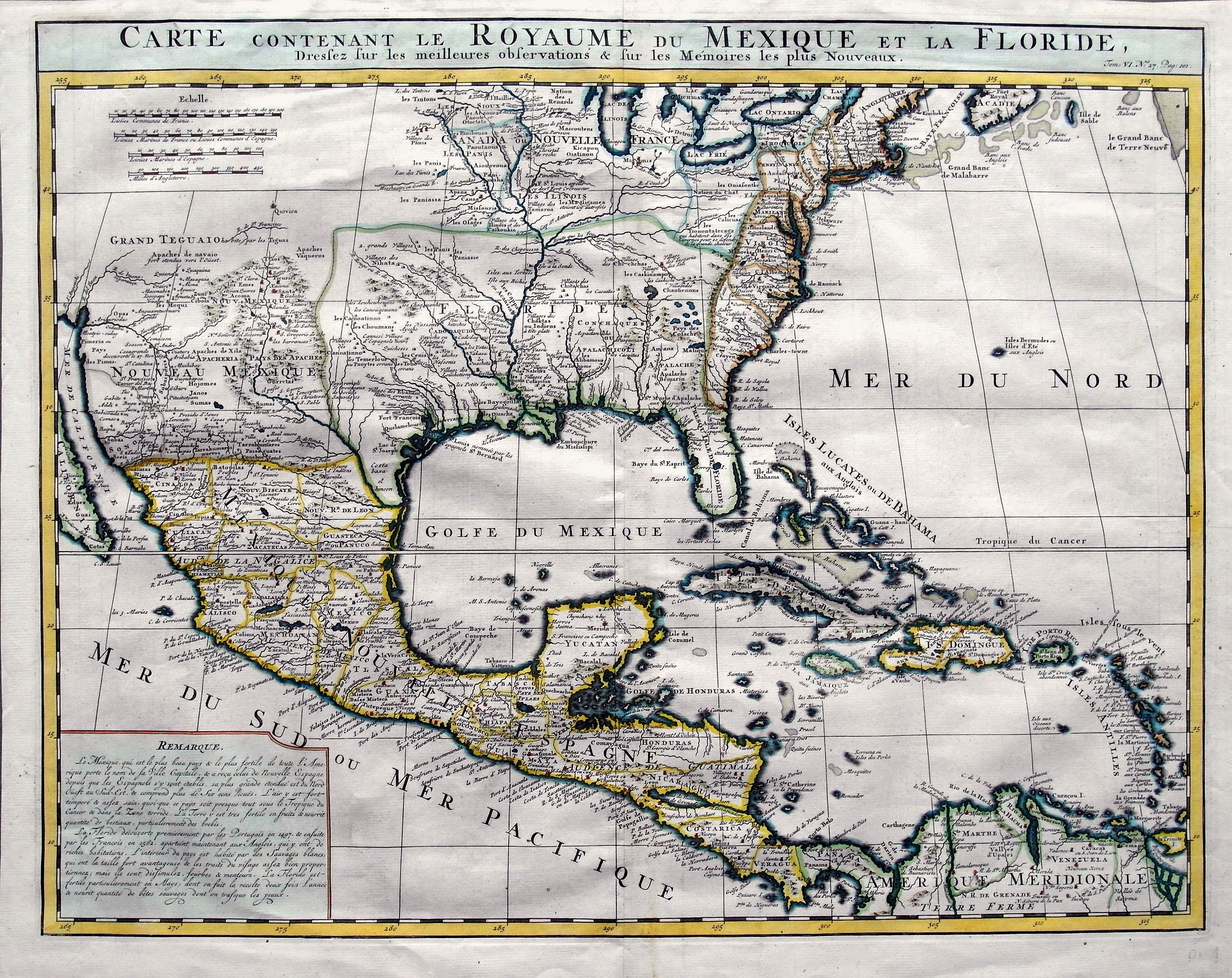
Title:
“Carte Contenant le Royaume du Mexique et la Floride …”
Map Maker:
Henry Abraham Chatelain
A double-page engraved map of Texas, Florida, the ... (full text available to subscribers)
| Item Detail |
| |
| |
MapMaker: |
Henry Abraham Chatelain
|
|
| |
| |
Subject: |
Eastern North America & West Indies |
|
| |
Period/Size: |
1719 / 16.1" x 20.6" (40.9 x 52.4 cm)
|
|
| |
Color: |
Colored
|
|
| |
Condition: |
In very good condition, good print, and nice colors! Fine hand-laid paper with a large watermark inside. Uneven margins, but outside of platemark. Some faint soiling and toning. (condition help) |
|
| |
Source: |
|
|
| |
References: |
|
|
| |
|
|
| Sales Information |
| |
| |
Price: |
|
|
| |
| |
Offered by: |
Paulus Swaen Old Maps & Prints |
|
| |
Catalog: |
March 19, 2019 - Internet Auction (9460) |
|
| |
Lot/Item #: |
82388 |
|
| |
| |
Date: |
03/2019
|
|
| |
| |
|
Antique Maps - Valuation and Pricing, Descriptions, Resources |
|
Home |
Information |
Search |
Register |
Contact Us |
Site Map
Americana Exchange, Inc. © 1999 - 2024 Americana Exchange, Inc.. All rights reserved.
OldMaps.com, the OldMaps.com logo and
AMPR are service marks or registered service marks of Americana Exchange, Inc..
|