Title:
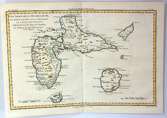
“Les Isles de la Guadeloupe, de Marie Galante, de la Desirade, et Celles des Saintes: Colonie Francoise dans les Antilles”
Map Maker:
Rigobert Bonne
A map of the French island of Gudeloupe with the i... (full text available to subscribers)
| Item Detail |
| |
| |
MapMaker: |
Rigobert Bonne
|
|
| |
| |
Subject: |
Lesser Antilles |
|
| |
Period/Size: |
1780 / 8.9" x 12.8" (22.6 x 32.6 cm)
|
|
| |
Color: |
Colored
|
|
| |
Condition: |
Original O/L Colours with enhancement in border. In fine condition with mild age toning.
Condition Rating (condition help) |
|
| |
Source: |
Atlas de Toutes les Parties Connues du Globe Terrestre |
|
| |
References: |
|
|
| |
|
|
| Sales Information |
| |
| |
Price: |
|
|
| |
| |
Offered by: |
Paulus Swaen Old Maps & Prints |
|
| |
Catalog: |
March 19, 2019 - Internet Auction (9460) |
|
| |
Lot/Item #: |
97698 |
|
| |
| |
Date: |
03/2019
|
|
| |
| |
|
Antique Maps - Valuation and Pricing, Descriptions, Resources |
|
Home |
Information |
Search |
Register |
Contact Us |
Site Map
Americana Exchange, Inc. © 1999 - 2024 Americana Exchange, Inc.. All rights reserved.
OldMaps.com, the OldMaps.com logo and
AMPR are service marks or registered service marks of Americana Exchange, Inc..
|