Title:
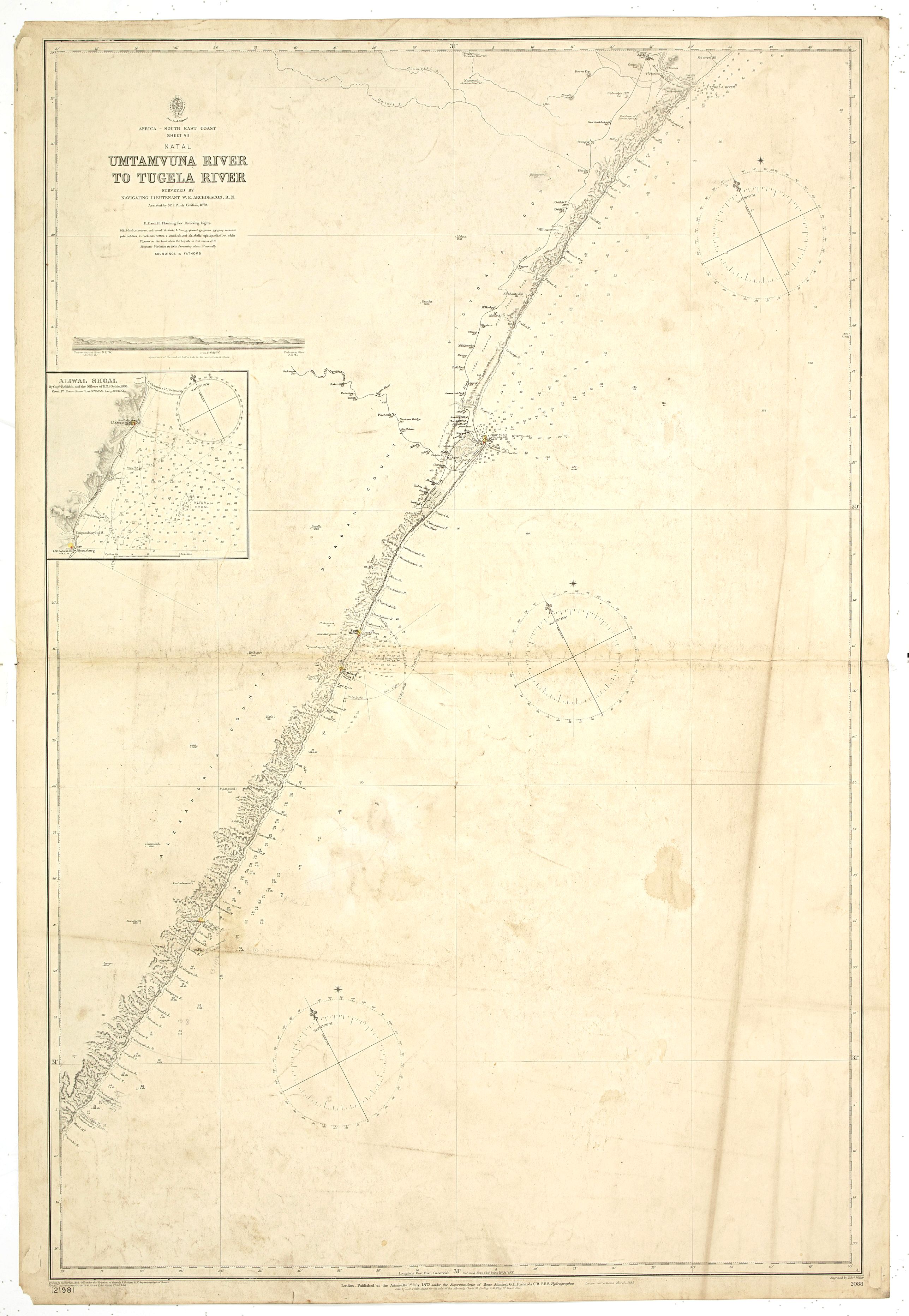
“Africa south east coast Sheet VII. Umtavuna River to Tugela River With two coastal profiles Surveyed by Navigating Lieutenant W.e. Archdeacon, R. N. Assisted by Mr. F. Purdy, Civilian, 1872…”
Map Maker:
British Admiralty
A fine Hydrographic Office chart no. 2088 (2198), ... (full text available to subscribers)
| Item Detail |
| |
| |
MapMaker: |
British Admiralty
|
|
| |
| |
Subject: |
Eastern Africa |
|
| |
Period/Size: |
1900 / 38.6" x 25.6" (98.1 x 65.1 cm)
|
|
| |
Color: |
Black & White
|
|
| |
Condition: |
Paper age-toned and dusty, a few brown stains. (condition help) |
|
| |
Source: |
|
|
| |
References: |
|
|
| |
|
|
| Sales Information |
| |
| |
Price: |
|
|
| |
| |
Offered by: |
Paulus Swaen Old Maps & Prints |
|
| |
Catalog: |
April 23, 2019 - Internet Auction (9464) |
|
| |
Lot/Item #: |
43734 |
|
| |
| |
Date: |
04/2019
|
|
| |
| |
|
Antique Maps - Valuation and Pricing, Descriptions, Resources |
|
Home |
Information |
Search |
Register |
Contact Us |
Site Map
Americana Exchange, Inc. © 1999 - 2024 Americana Exchange, Inc.. All rights reserved.
OldMaps.com, the OldMaps.com logo and
AMPR are service marks or registered service marks of Americana Exchange, Inc..
|