Title:
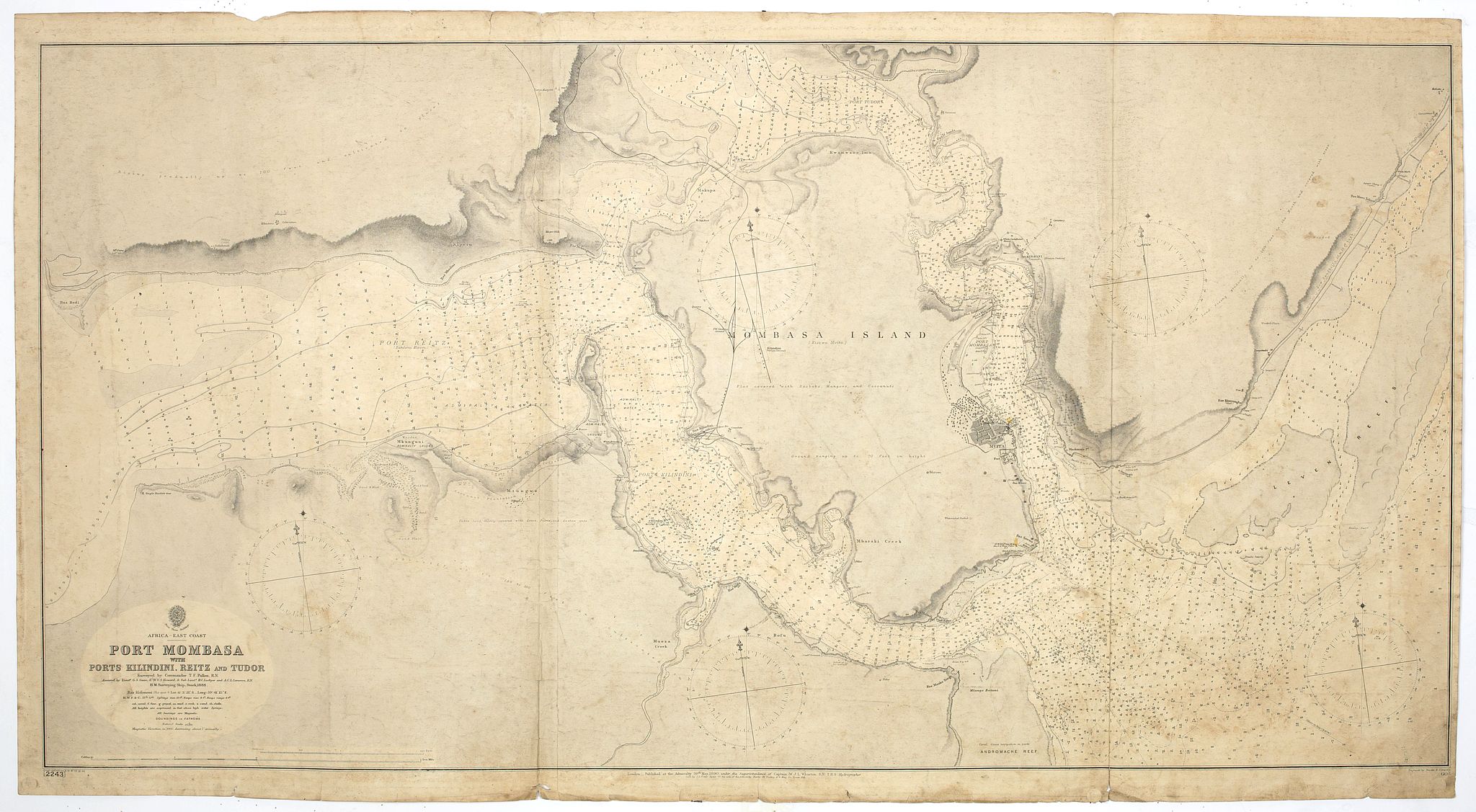
“ Africa east coast, Port Mombasa with Ports Kilindini, Reitz and Tudor� H. M. Surveying ship Stork, 1888. Africa - SW coast Table Bay surveyed by Mr F Skead Master RN assisted by Mr Charles Watermeyer 1858-60”
Map Maker:
British Admiralty
A fine Hydrographic Office chart no. 666 (2243), s... (full text available to subscribers)
| Item Detail |
| |
| |
MapMaker: |
British Admiralty
|
|
| |
| |
Subject: |
Eastern Africa |
|
| |
Period/Size: |
1900 / 26.0" x 50.4" (66.1 x 128.1 cm)
|
|
| |
Color: |
Black & White
|
|
| |
Condition: |
Paper age-toned and dusty. Two large tears in the middle of the folds (condition help) |
|
| |
Source: |
|
|
| |
References: |
|
|
| |
|
|
| Sales Information |
| |
| |
Price: |
|
|
| |
| |
Offered by: |
Paulus Swaen Old Maps & Prints |
|
| |
Catalog: |
April 23, 2019 - Internet Auction (9464) |
|
| |
Lot/Item #: |
43769 |
|
| |
| |
Date: |
04/2019
|
|
| |
| |
|
Antique Maps - Valuation and Pricing, Descriptions, Resources |
|
Home |
Information |
Search |
Register |
Contact Us |
Site Map
Americana Exchange, Inc. © 1999 - 2024 Americana Exchange, Inc.. All rights reserved.
OldMaps.com, the OldMaps.com logo and
AMPR are service marks or registered service marks of Americana Exchange, Inc..
|