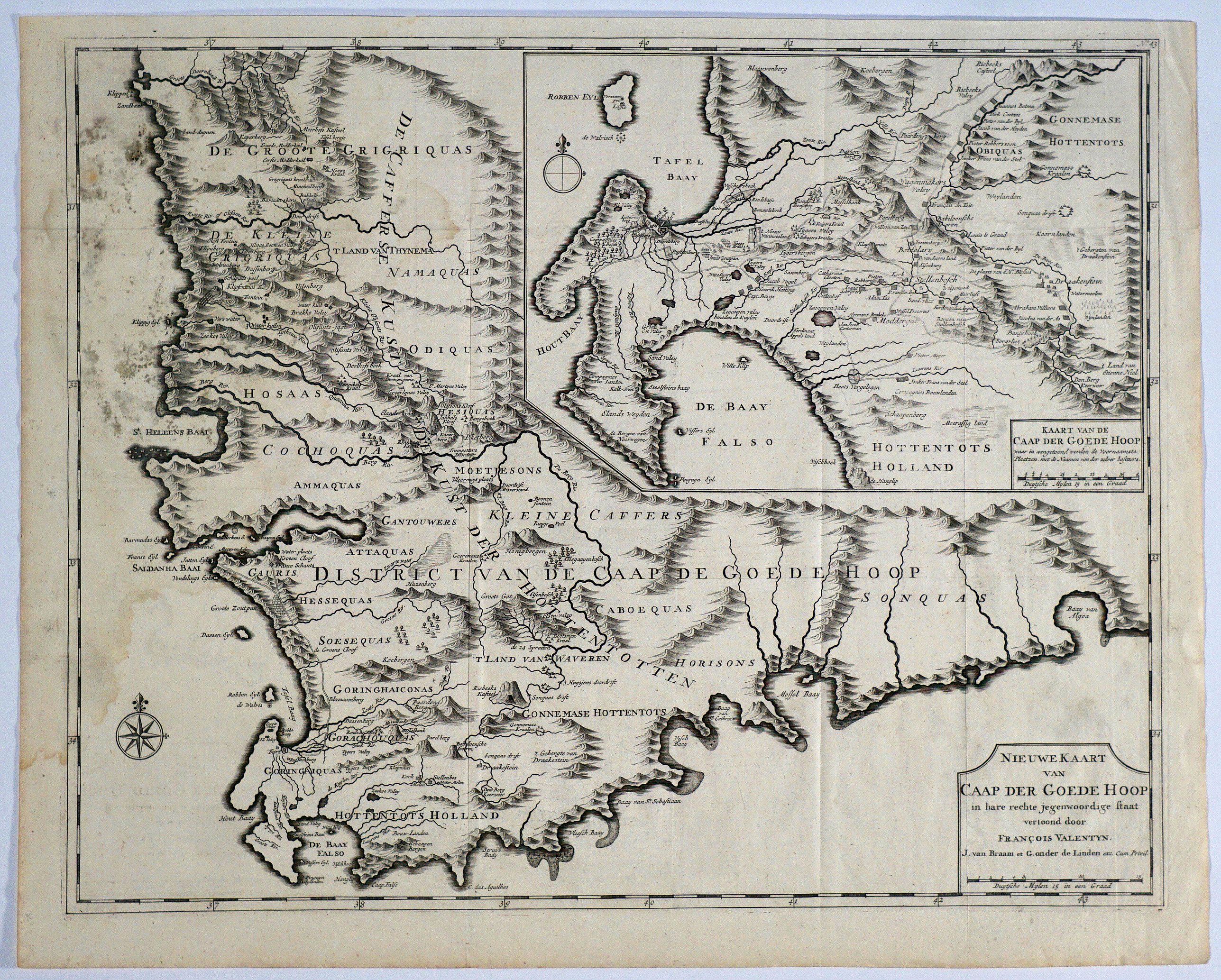
Title:
“Nieuwe Kaart van Caap der Goede Hoop in hare rechte jegenwoordige staaat vertoond door Francois Valentyn”
Map Maker:
Francois Valentijn
An attractive & detailed map of the Cape region, o... (full text available to subscribers)
| Item Detail |
| |
| |
MapMaker: |
Francois Valentijn
|
|
| |
| |
Subject: |
Southern Africa |
|
| |
Period/Size: |
1724 / 17.4" x 22.1" (44.2 x 56.2 cm)
|
|
| |
Color: |
Black & White
|
|
| |
Condition: |
Dark impression, folds as issued. One small paper abrasion and some water staining/soiling at left respectively upper left part of the map, the latter mostly affecting the ocean with a few small spots in the engraved area. (condition help) |
|
| |
Source: |
Oud en Nieuw Oost Indien |
|
| |
References: |
Tooley MCC 61 : Maps of South Africa #282. |
|
| |
|
|
| Sales Information |
| |
| |
Price: |
|
|
| |
| |
Offered by: |
Paulus Swaen Old Maps & Prints |
|
| |
Catalog: |
April 23, 2019 - Internet Auction (9464) |
|
| |
Lot/Item #: |
82462 |
|
| |
| |
Date: |
04/2019
|
|
| |
| |
|
Antique Maps - Valuation and Pricing, Descriptions, Resources |
|
Home |
Information |
Search |
Register |
Contact Us |
Site Map
Americana Exchange, Inc. © 1999 - 2024 Americana Exchange, Inc.. All rights reserved.
OldMaps.com, the OldMaps.com logo and
AMPR are service marks or registered service marks of Americana Exchange, Inc..
|