Title:
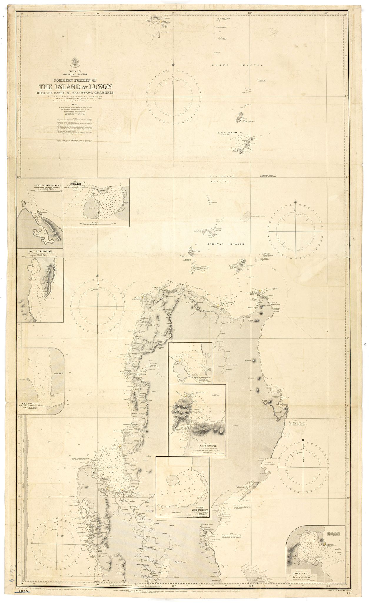
“Northern Portion of The Island of Luzon with the Bashi & Balintang Channels The Island of Luzon by Lieutenant Claudio Montero Royal Spanish Navy 1859 The Batan Islands by Captain Sir. E. Belcher R.N. 1845”
Map Maker:
British Admiralty
Two sheets joined. Detailed chart on two joined sh... (full text available to subscribers)
| Item Detail |
| |
| |
MapMaker: |
British Admiralty
|
|
| |
| |
Subject: |
Philippines |
|
| |
Period/Size: |
c. 1903 / 44.5" x 25.4" (113.1 x 64.6 cm)
|
|
| |
Color: |
Black & White
|
|
| |
Condition: |
Slightly browning and offsetting, a few tears along borders and folders. Folded in three. Additional lines in pencil. (condition help) |
|
| |
Source: |
|
|
| |
References: |
|
|
| |
|
|
| Sales Information |
| |
| |
Price: |
|
|
| |
| |
Offered by: |
Paulus Swaen Old Maps & Prints |
|
| |
Catalog: |
April 23, 2019 - Internet Auction (9464) |
|
| |
Lot/Item #: |
43704 |
|
| |
| |
Date: |
04/2019
|
|
| |
| |
|
Antique Maps - Valuation and Pricing, Descriptions, Resources |
|
Home |
Information |
Search |
Register |
Contact Us |
Site Map
Americana Exchange, Inc. © 1999 - 2024 Americana Exchange, Inc.. All rights reserved.
OldMaps.com, the OldMaps.com logo and
AMPR are service marks or registered service marks of Americana Exchange, Inc..
|