Title:
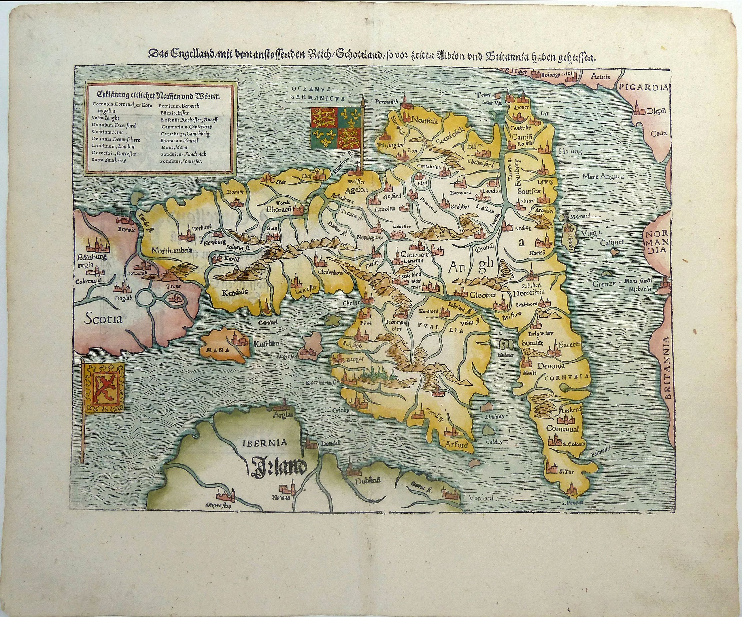
“Das Kunigreich Engellandt mit dem Anstossenden Reich Schottlandt so vor Zeiten Albion und Britannia haben Geheissen”
Map Maker:
Sebastian Munster
An early, unusual woodcut map of the British Isles... (full text available to subscribers)
| Item Detail |
| |
| |
MapMaker: |
Sebastian Munster
|
|
| |
| |
Subject: |
England & Wales |
|
| |
Period/Size: |
c. 1540 / 9.9" x 13.5" (25.2 x 34.3 cm)
|
|
| |
Color: |
Colored
|
|
| |
Condition: |
In fine condition with good margins and good paper. (condition help) |
|
| |
Source: |
Cosmographey oder beschreibung aller Länder |
|
| |
References: |
|
|
| |
|
|
| Sales Information |
| |
| |
Price: |
|
|
| |
| |
Offered by: |
Paulus Swaen Old Maps & Prints |
|
| |
Catalog: |
April 23, 2019 - Internet Auction (9464) |
|
| |
Lot/Item #: |
82479 |
|
| |
| |
Date: |
04/2019
|
|
| |
| |
|
Antique Maps - Valuation and Pricing, Descriptions, Resources |
|
Home |
Information |
Search |
Register |
Contact Us |
Site Map
Americana Exchange, Inc. © 1999 - 2024 Americana Exchange, Inc.. All rights reserved.
OldMaps.com, the OldMaps.com logo and
AMPR are service marks or registered service marks of Americana Exchange, Inc..
|