Rister or Sign In to see pricing information


Title:

Nieuwe Zeekaart van het Tweede gedeelte van het Canaal Tusschen Engeland en Vrankryk / ...Chanell betwext England and France

Map Maker:

Johannes van Keulen

	Nieuwe Zeekaart van het Tweede gedeelte van het Canaal Tusschen Engeland en Vrankryk / ...Chanell betwext England and France

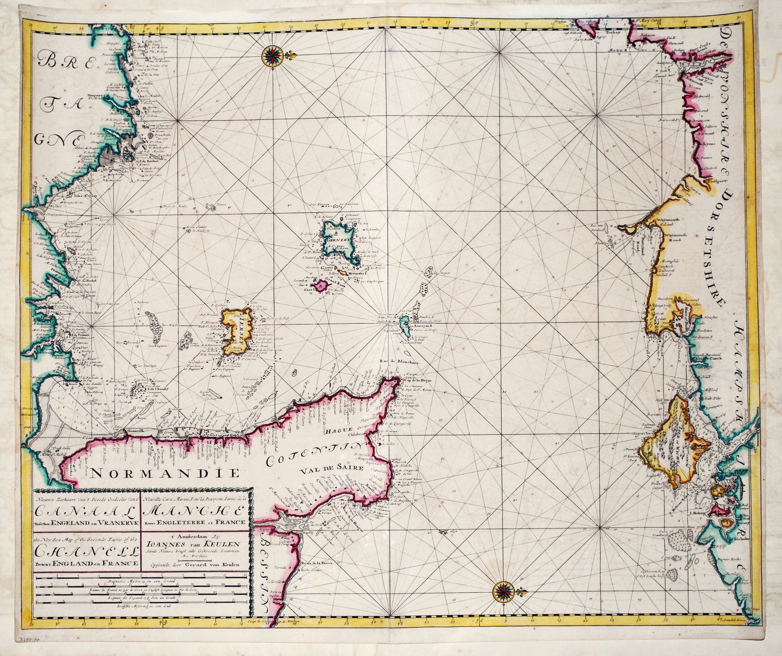
A detailed chart of the Channel with the coasts of... (full text available to subscribers)
Item Detail
 
  MapMaker:  

Johannes van Keulen


  Subject:  Northern Europe, English Channel  
  Period/Size:  c. 1685 / 20.1" x 23.9"  (51.1 x 60.7 cm)  
  Color:  Colored  
  Condition:  A small unobtrusive restoration in lower fold, otherwise in very good condition. (condition help)  
  Source:   
  References:  Koeman, part IV, p.375, chart [192].  
 
 
Sales Information
 
  Price: 

Please register your email to view records, or sign in with email address to see records


  Offered by:  Paulus Swaen Old Maps & Prints  
  Catalog:  April 23, 2019 - Internet Auction (9464)  
  Lot/Item #:  82021  
 
  Date:  04/2019  


Antique Maps - Valuation and Pricing, Descriptions, Resources


Home | Information | Search | Register | Contact Us | Site Map

Americana Exchange, Inc. © 1999 - 2024 Americana Exchange, Inc.. All rights reserved. OldMaps.com, the OldMaps.com logo and
AMPR are service marks or registered service marks of Americana Exchange, Inc..