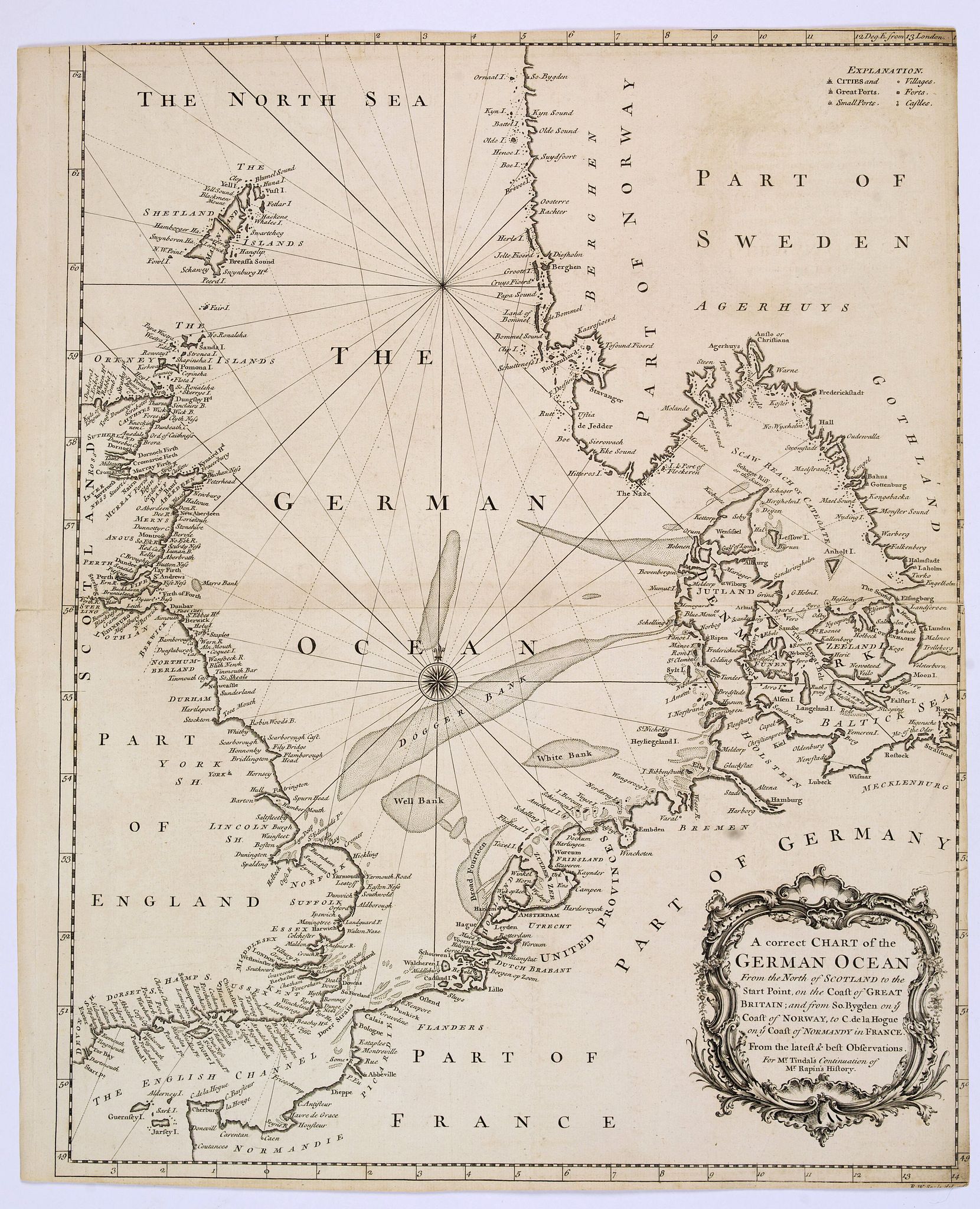
Title:
“A correct Chart of the German Ocean, from the North of Scotland to the Start Point. . .”
Map Maker:
Richard William Seale
A chart of the German Ocean published in Nicholas ... (full text available to subscribers)
| Item Detail |
| |
| |
MapMaker: |
Richard William Seale
|
|
| |
| |
Subject: |
Northern Europe, North Sea |
|
| |
Period/Size: |
1746 / 18.3" x 14.8" (46.5 x 37.6 cm)
|
|
| |
Color: |
Black & White
|
|
| |
Condition: |
In fair / good condition. Some margins slightly cropped or slim. Lightly age toned. Centrefold. Two small splits to centerfold. (condition help) |
|
| |
Source: |
|
|
| |
References: |
|
|
| |
|
|
| Sales Information |
| |
| |
Price: |
|
|
| |
| |
Offered by: |
Paulus Swaen Old Maps & Prints |
|
| |
Catalog: |
April 23, 2019 - Internet Auction (9464) |
|
| |
Lot/Item #: |
43781 |
|
| |
| |
Date: |
04/2019
|
|
| |
| |
|
Antique Maps - Valuation and Pricing, Descriptions, Resources |
|
Home |
Information |
Search |
Register |
Contact Us |
Site Map
Americana Exchange, Inc. © 1999 - 2024 Americana Exchange, Inc.. All rights reserved.
OldMaps.com, the OldMaps.com logo and
AMPR are service marks or registered service marks of Americana Exchange, Inc..
|