Title:
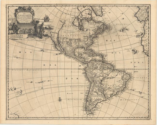
“Nouvelle Carte de l'Amerique, avec Tous ses Royaumes, Etats, Iles, Ports, Bayes et Rivieres, Dressee Suivant les Plus Nouvelles Decouvertes par les Habiles Geographes...”
Map Maker:
Pieter van der Aa
Van der Aa's scarce map of the Americas was first ... (full text available to subscribers)
| Item Detail |
| |
| |
MapMaker: |
Pieter van der Aa
|
|
| |
| |
Subject: |
Western Hemisphere - America |
|
| |
Period/Size: |
1720 / 17.0" x 21.1" (43.2 x 53.6 cm)
|
|
| |
Color: |
Black & White
|
|
| |
Condition: |
(A) A very dark impression with printer's ink residue, issued folding on paper with a Strasburg Lily watermark. There are a couple of short fold separations in the blank margins that have been archivally repaired. (condition help) |
|
| |
Source: |
|
|
| |
References: |
Tooley (Amer) 72 (Plt #55); McLaughlin #187. |
|
| |
|
|
| Sales Information |
| |
| |
Price: |
|
|
| |
| |
Offered by: |
Old World Auctions |
|
| |
Catalog: |
Auction No. 169 - Antique Maps, Charts, Atlases & Globes (9467) |
|
| |
Lot/Item #: |
078 |
|
| |
| |
Date: |
09/2018
|
|
| |
| |
|
Antique Maps - Valuation and Pricing, Descriptions, Resources |
|
Home |
Information |
Search |
Register |
Contact Us |
Site Map
Americana Exchange, Inc. © 1999 - 2024 Americana Exchange, Inc.. All rights reserved.
OldMaps.com, the OldMaps.com logo and
AMPR are service marks or registered service marks of Americana Exchange, Inc..
|