| Item Detail |
| |
| |
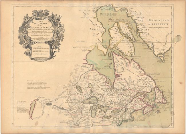
MapMaker: |
Guillaume Delisle
|
|
| |
| |
Subject: |
Colonial Northeastern United States & Canada, Great Lakes |
|
| |
Period/Size: |
1703 / 19.6" x 25.6" (49.8 x 65.1 cm)
|
|
| |
Color: |
Colored
|
|
| |
Condition: |
(B+) A nice impression on watermarked paper with original wash and outline color. There are several small stains in the bottom corners of the map, an archivally repaired centerfold separation confined to the bottom blank margin, and light toning along th (condition help) |
|
| |
Source: |
|
|
| |
References: |
Kershaw #311; cf. Schwartz & Ehrenberg p. 135-137, Plt. 80; Tooley (Amer), p. 20, #37. |
|
| |
|
|
| Sales Information |
| |
| |
Price: |
|
|
| |
| |
Offered by: |
Old World Auctions |
|
| |
Catalog: |
Auction No. 169 - Antique Maps, Charts, Atlases & Globes (9467) |
|
| |
Lot/Item #: |
130 |
|
| |
| |
Date: |
09/2018
|
|
| |
| |
|