| Item Detail |
| |
| |
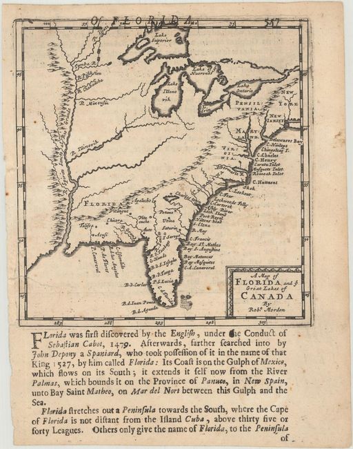
MapMaker: |
Robert Morden
|
|
| |
| |
Subject: |
Colonial Eastern United States |
|
| |
Period/Size: |
1688 / 5.1" x 4.9" (13.0 x 12.5 cm)
|
|
| |
Color: |
Black & White
|
|
| |
Condition: |
(B+) There are a few spots of foxing and a couple of repaired edge tears at left, including one that extends 0.75" into the image. (condition help) |
|
| |
Source: |
Geography Rectified |
|
| |
References: |
Cumming (SE) #109; Phillips (Maps) p. 565. |
|
| |
|
|
| Sales Information |
| |
| |
Price: |
|
|
| |
| |
Offered by: |
Old World Auctions |
|
| |
Catalog: |
Auction No. 169 - Antique Maps, Charts, Atlases & Globes (9467) |
|
| |
Lot/Item #: |
158 |
|
| |
| |
Date: |
09/2018
|
|
| |
| |
|