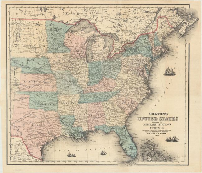
Title:
“Colton's United States Shewing the Military Stations Forts &c”
Map Maker:
Joseph Hutchins Colton
This unusual, Civil War period map covers t... (full text available to subscribers)
| Item Detail |
| |
| |
MapMaker: |
Joseph Hutchins Colton
|
|
| |
| |
Subject: |
Eastern United States, Civil War |
|
| |
Period/Size: |
1861 / 14.8" x 17.4" (37.6 x 44.2 cm)
|
|
| |
Color: |
Colored
|
|
| |
Condition: |
(B+) Issued folding with a 2" edge tear at left that has been repaired on verso with archival material. (condition help) |
|
| |
Source: |
Victor's History of the Southern Rebellion |
|
| |
References: |
Phillips (Maps) p. 909. |
|
| |
|
|
| Sales Information |
| |
| |
Price: |
|
|
| |
| |
Offered by: |
Old World Auctions |
|
| |
Catalog: |
Auction No. 169 - Antique Maps, Charts, Atlases & Globes (9467) |
|
| |
Lot/Item #: |
172 |
|
| |
| |
Date: |
09/2018
|
|
| |
| |
|
Antique Maps - Valuation and Pricing, Descriptions, Resources |
|
Home |
Information |
Search |
Register |
Contact Us |
Site Map
Americana Exchange, Inc. © 1999 - 2024 Americana Exchange, Inc.. All rights reserved.
OldMaps.com, the OldMaps.com logo and
AMPR are service marks or registered service marks of Americana Exchange, Inc..
|