Title:
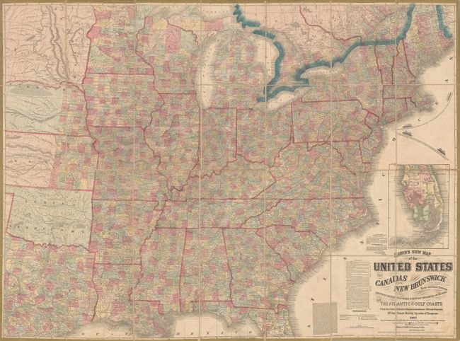
“Lloyd's New Map of the United States the Canadas and New Brunswick from the Latest Surveys Showing Every Railroad & Station Finished to June 1862 and the Atlantic and Gulf Coasts...”
Map Maker:
James T. Lloyd
This large Civil War era map covers the United Sta... (full text available to subscribers)
| Item Detail |
| |
| |
MapMaker: |
James T. Lloyd
|
|
| |
| |
Subject: |
Eastern United States |
|
| |
Period/Size: |
1863 / 37.3" x 49.9" (94.8 x 126.8 cm)
|
|
| |
Color: |
Colored
|
|
| |
Condition: |
(B+) An overall impressive example with some light staining confined to the area around the title at bottom right. There is one tiny hole just south of Jefferson City, Missouri next to the linen fold line. The modern clamshell case is fine. (condition help) |
|
| |
Source: |
|
|
| |
References: |
Stephenson (CW) #41.4. |
|
| |
|
|
| Sales Information |
| |
| |
Price: |
|
|
| |
| |
Offered by: |
Old World Auctions |
|
| |
Catalog: |
Auction No. 169 - Antique Maps, Charts, Atlases & Globes (9467) |
|
| |
Lot/Item #: |
173 |
|
| |
| |
Date: |
09/2018
|
|
| |
| |
|
Antique Maps - Valuation and Pricing, Descriptions, Resources |
|
Home |
Information |
Search |
Register |
Contact Us |
Site Map
Americana Exchange, Inc. © 1999 - 2024 Americana Exchange, Inc.. All rights reserved.
OldMaps.com, the OldMaps.com logo and
AMPR are service marks or registered service marks of Americana Exchange, Inc..
|