Title:
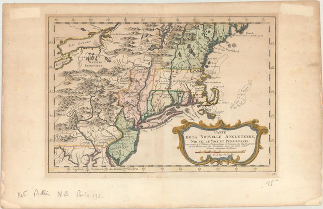
“Carte de la Nouvelle Angleterre, Nouvelle York et Pensilvanie pour Servir a l'Histoire Philosophique & Politique des Etablissemens et du Commerce des Europeens dans les Deux Indes”
Map Maker:
Jacques Nicolas Bellin
This French & Indian War period map details... (full text available to subscribers)
| Item Detail |
| |
| |
MapMaker: |
Jacques Nicolas Bellin
|
|
| |
| |
Subject: |
Colonial New England & Mid-Atlantic United States |
|
| |
Period/Size: |
1783 / 7.9" x 11.6" (20.1 x 29.5 cm)
|
|
| |
Color: |
Colored
|
|
| |
Condition: |
(B+) A dark impression with a small tear adjacent to the centerfold (Long Island) and light toning. There are minor tape stains in the blank margins. (condition help) |
|
| |
Source: |
Atlas Portatif pour...Histoire Philosophique et Politique... |
|
| |
References: |
McCorkle #757.1; Sellers & Van Ee #721. |
|
| |
|
|
| Sales Information |
| |
| |
Price: |
|
|
| |
| |
Offered by: |
Old World Auctions |
|
| |
Catalog: |
Auction No. 169 - Antique Maps, Charts, Atlases & Globes (9467) |
|
| |
Lot/Item #: |
174 |
|
| |
| |
Date: |
09/2018
|
|
| |
| |
|
Antique Maps - Valuation and Pricing, Descriptions, Resources |
|
Home |
Information |
Search |
Register |
Contact Us |
Site Map
Americana Exchange, Inc. © 1999 - 2024 Americana Exchange, Inc.. All rights reserved.
OldMaps.com, the OldMaps.com logo and
AMPR are service marks or registered service marks of Americana Exchange, Inc..
|