| Item Detail |
| |
| |
MapMaker: |
Infrequent Publ. - Anthropomorphic & Cartoon Maps
|
|
| |
| |
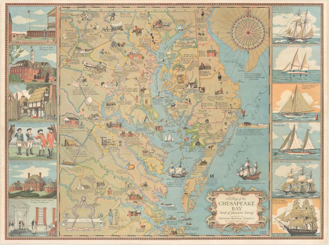
Subject: |
Eastern Virginia, Maryland, Delaware |
|
| |
Period/Size: |
1959 / 20.6" x 27.7" (52.4 x 70.4 cm)
|
|
| |
Color: |
Colored
|
|
| |
Condition: |
(B+) A colorful example with a 3" tear just above the Capitol and a 3" edge tear at bottom that have been archivally repaired on verso. (condition help) |
|
| |
Source: |
|
|
| |
References: |
|
|
| |
|
|
| Sales Information |
| |
| |
Price: |
|
|
| |
| |
Offered by: |
Old World Auctions |
|
| |
Catalog: |
Auction No. 169 - Antique Maps, Charts, Atlases & Globes (9467) |
|
| |
Lot/Item #: |
186 |
|
| |
| |
Date: |
09/2018
|
|
| |
| |
|