| Item Detail |
| |
| |
MapMaker: |
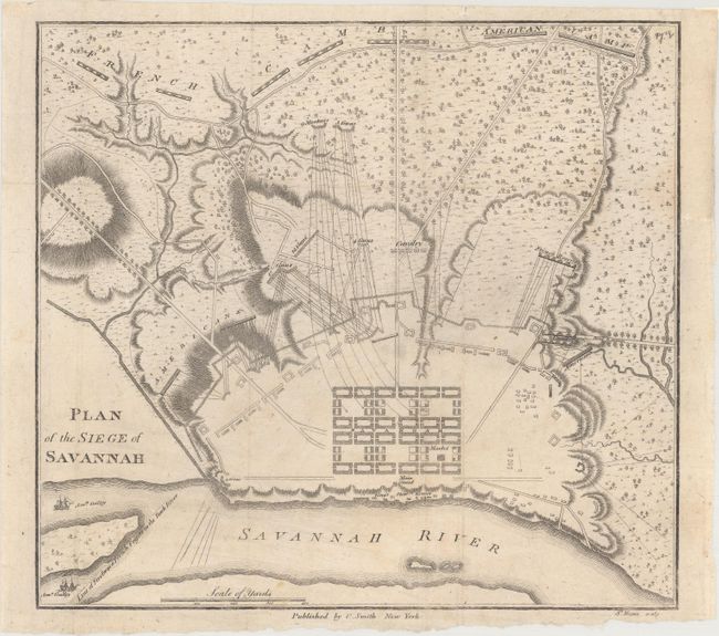
Charles Smith
|
|
| |
| |
Subject: |
Savannah, Georgia, Revolutionary War |
|
| |
Period/Size: |
1796 / 8.4" x 9.1" (21.4 x 23.2 cm)
|
|
| |
Color: |
Black & White
|
|
| |
Condition: |
(B+) Issued folding, now flat, with light soiling and a binding trim that has been seamlessly replaced with old paper at top right. There are remnants of hinge tape on verso. (condition help) |
|
| |
Source: |
The Monthly Military Repository |
|
| |
References: |
Phillips (Maps) p. 786; Wheat & Brun #617. |
|
| |
|
|
| Sales Information |
| |
| |
Price: |
|
|
| |
| |
Offered by: |
Old World Auctions |
|
| |
Catalog: |
Auction No. 169 - Antique Maps, Charts, Atlases & Globes (9467) |
|
| |
Lot/Item #: |
245 |
|
| |
| |
Date: |
09/2018
|
|
| |
| |
|