| Item Detail |
| |
| |
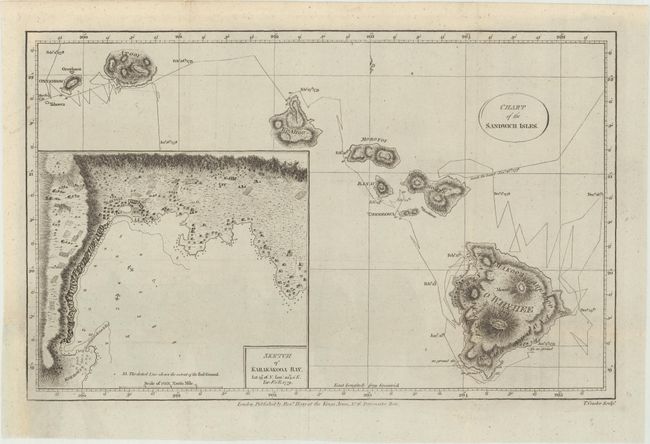
MapMaker: |
Cook/Hogg
|
|
| |
| |
Subject: |
Hawaii |
|
| |
Period/Size: |
1785 / 8.3" x 13.3" (21.1 x 33.8 cm)
|
|
| |
Color: |
Black & White
|
|
| |
Condition: |
(A) Issued folding, now flattened, with a binding trim at bottom left that has been professionally replaced with period-correct paper, and a tiny binding tear that just enters the map border that has also been professionally repaired. (condition help) |
|
| |
Source: |
New Authentic and Complete Collection of Voyages Round the World… |
|
| |
References: |
cf. Fitzpatrick pp.16-17. |
|
| |
|
|
| Sales Information |
| |
| |
Price: |
|
|
| |
| |
Offered by: |
Old World Auctions |
|
| |
Catalog: |
Auction No. 169 - Antique Maps, Charts, Atlases & Globes (9467) |
|
| |
Lot/Item #: |
247 |
|
| |
| |
Date: |
09/2018
|
|
| |
| |
|