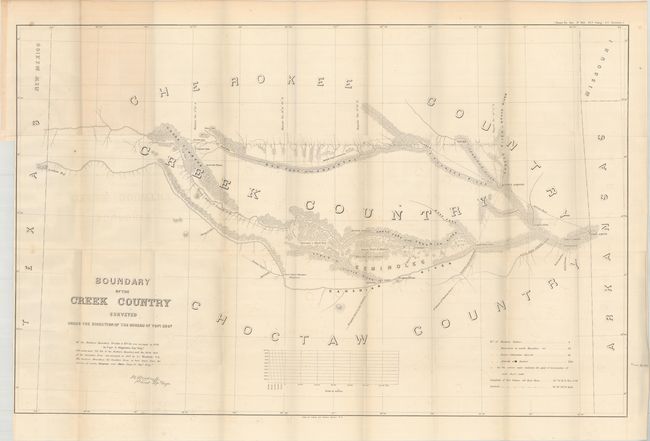
Title:
“Boundary of the Creek Country Surveyed Under the Direction of the Bureau of Topl. Engs.”
Map Maker:
Lorenzo Sitgreaves
The area covered by Sitgreaves' large map lies in ... (full text available to subscribers)
| Item Detail |
| |
| |
MapMaker: |
Lorenzo Sitgreaves
|
|
| |
| |
Subject: |
Oklahoma |
|
| |
Period/Size: |
1858 / 23.8" x 37.1" (60.5 x 94.3 cm)
|
|
| |
Color: |
Black & White
|
|
| |
Condition: |
(B+) Issued folding with faint offsetting and a few short splits at fold intersections. Binding trim at left. (condition help) |
|
| |
Source: |
House Ex. Doc. No. 104 35th Cong. 1st Session |
|
| |
References: |
Phillips (Maps) p. 251. |
|
| |
|
|
| Sales Information |
| |
| |
Price: |
|
|
| |
| |
Offered by: |
Old World Auctions |
|
| |
Catalog: |
Auction No. 169 - Antique Maps, Charts, Atlases & Globes (9467) |
|
| |
Lot/Item #: |
284 |
|
| |
| |
Date: |
09/2018
|
|
| |
| |
|
Antique Maps - Valuation and Pricing, Descriptions, Resources |
|
Home |
Information |
Search |
Register |
Contact Us |
Site Map
Americana Exchange, Inc. © 1999 - 2024 Americana Exchange, Inc.. All rights reserved.
OldMaps.com, the OldMaps.com logo and
AMPR are service marks or registered service marks of Americana Exchange, Inc..
|