| Item Detail |
| |
| |
MapMaker: |
Alain Manesson-Mallet
|
|
| |
| |
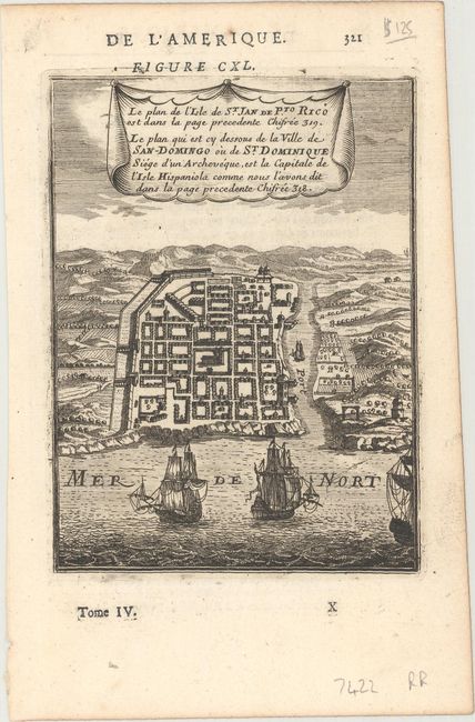
Subject: |
Santo Domingo, Dominican Republic |
|
| |
Period/Size: |
1683 / 5.8" x 4.3" (14.8 x 11.0 cm)
|
|
| |
Color: |
Black & White
|
|
| |
Condition: |
(A) A nice impression on a watermarked sheet with marginal soiling. (condition help) |
|
| |
Source: |
Description de l'Univers |
|
| |
References: |
Pastoureau, MANESSON-MALLET IA, Tome V #647. |
|
| |
|
|
| Sales Information |
| |
| |
Price: |
|
|
| |
| |
Offered by: |
Old World Auctions |
|
| |
Catalog: |
Auction No. 169 - Antique Maps, Charts, Atlases & Globes (9467) |
|
| |
Lot/Item #: |
359 |
|
| |
| |
Date: |
09/2018
|
|
| |
| |
|