| Item Detail |
| |
| |
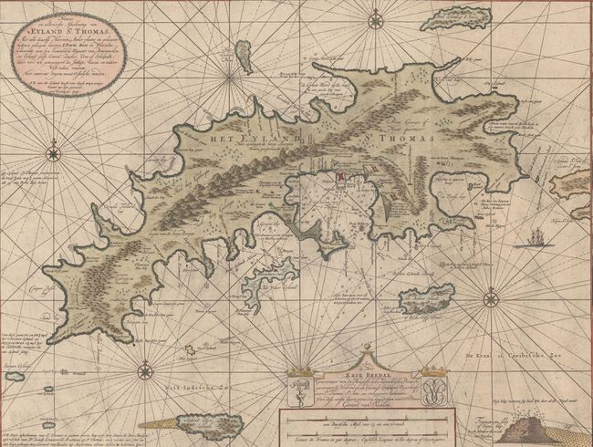
MapMaker: |
Gerard van Keulen
|
|
| |
| |
Subject: |
St. Thomas, US Virgin Islands |
|
| |
Period/Size: |
1719 / 23.4" x 39.3" (59.5 x 99.9 cm)
|
|
| |
Color: |
Colored
|
|
| |
Condition: |
(A) A dark impression with light printer's ink residue, issued folding and now flattened. There are minor damp stains along the edges of the sheet that are entirely confined to the blank margins, and one short tear in the bottom blank margin that has bee (condition help) |
|
| |
Source: |
De Groote Nieuwe Vermeerderde Zee Atlas ofte Water-Waereld |
|
| |
References: |
|
|
| |
|
|
| Sales Information |
| |
| |
Price: |
|
|
| |
| |
Offered by: |
Old World Auctions |
|
| |
Catalog: |
Auction No. 169 - Antique Maps, Charts, Atlases & Globes (9467) |
|
| |
Lot/Item #: |
365 |
|
| |
| |
Date: |
09/2018
|
|
| |
| |
|