Title:
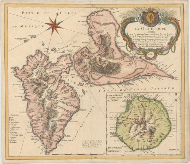
“La Guadeloupe Dediee a Mgr. Charles Philippe d'Albert Duc de Luynes...”
Map Maker:
George Louis Le Rouge
This handsome chart shows Guadeloupe. The islands... (full text available to subscribers)
| Item Detail |
| |
| |
MapMaker: |
George Louis Le Rouge
|
|
| |
| |
Subject: |
Guadeloupe |
|
| |
Period/Size: |
1788 / 18.3" x 21.1" (46.5 x 53.6 cm)
|
|
| |
Color: |
Colored
|
|
| |
Condition: |
(B+) A nice impression on paper with a large house watermark and very light soiling. (condition help) |
|
| |
Source: |
Atlas Ameriquain |
|
| |
References: |
Sellers & Van Ee #2007; Shirley (BL Atlases) T.LER-3a #26. |
|
| |
|
|
| Sales Information |
| |
| |
Price: |
|
|
| |
| |
Offered by: |
Old World Auctions |
|
| |
Catalog: |
Auction No. 169 - Antique Maps, Charts, Atlases & Globes (9467) |
|
| |
Lot/Item #: |
369 |
|
| |
| |
Date: |
09/2018
|
|
| |
| |
|
Antique Maps - Valuation and Pricing, Descriptions, Resources |
|
Home |
Information |
Search |
Register |
Contact Us |
Site Map
Americana Exchange, Inc. © 1999 - 2024 Americana Exchange, Inc.. All rights reserved.
OldMaps.com, the OldMaps.com logo and
AMPR are service marks or registered service marks of Americana Exchange, Inc..
|